Moose Lake, Minnesota
| Moose Lake, Minnesota | |
|---|---|
| City | |
|
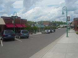
Downtown Moose Lake | |
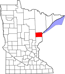
 Location of the city of Moose Lake within Carlton County, Minnesota | |
| Coordinates: 46°27′5″N 92°45′48″W / 46.45139°N 92.76333°W | |
| Country | United States |
| State | Minnesota |
| County | Carlton |
| Area[1] | |
| • Total | 3.66 sq mi (9.48 km2) |
| • Land | 3.27 sq mi (8.47 km2) |
| • Water | 0.39 sq mi (1.01 km2) |
| Elevation | 1,060 ft (323 m) |
| Population (2010)[2] | |
| • Total | 2,751 |
| • Estimate (2012[3]) | 2,787 |
| • Density | 841.3/sq mi (324.8/km2) |
| Time zone | Central (CST) (UTC-6) |
| • Summer (DST) | CDT (UTC-5) |
| ZIP code | 55767 |
| Area code(s) | 218 |
| FIPS code | 27-43954[4] |
| GNIS feature ID | 0648082[5] |
| Website | www.cityofmooselake.com |
Moose Lake is a city in Carlton County, Minnesota, United States. The population was 2,751 at the 2010 census.[6]
Interstate 35; Minnesota State Highways 27 and 73; and County 61 are four of the main routes in Moose Lake.
Moose Lake State Park is nearby.
Geography
According to the United States Census Bureau, the city has a total area of 3.66 square miles (9.48 km2), of which, 3.27 square miles (8.47 km2) is land and 0.39 square miles (1.01 km2) is water.[1]
The boundary line between Carlton and Pine counties is nearby.
Moose Lake is located 25 miles southwest of Cloquet. Moose Lake is located 43 miles southwest of Duluth; and 112 miles north of Minneapolis–Saint Paul.
Climate
As with the rest of Minnesota, Moose Lake has a humid continental climate.[7] Similar to the rest of the northern half of the state it has the warm-summer variety with relatively cool nights year-round. Winter temperatures are very cold but dry compared to summer.
| Climate data for Moose Lake | |||||||||||||
|---|---|---|---|---|---|---|---|---|---|---|---|---|---|
| Month | Jan | Feb | Mar | Apr | May | Jun | Jul | Aug | Sep | Oct | Nov | Dec | Year |
| Record high °C (°F) | 12.8 (55) |
13.9 (57) |
26.7 (80.1) |
33.3 (91.9) |
33.9 (93) |
37.2 (99) |
40.0 (104) |
37.2 (99) |
36.1 (97) |
30.6 (87.1) |
22.2 (72) |
13.9 (57) |
40.0 (104) |
| Average high °C (°F) | −6.7 (19.9) |
−3.6 (25.5) |
2.9 (37.2) |
11.8 (53.2) |
19.3 (66.7) |
24.1 (75.4) |
27.4 (81.3) |
25.9 (78.6) |
20.4 (68.7) |
13.7 (56.7) |
3.4 (38.1) |
−4.2 (24.4) |
11.2 (52.2) |
| Daily mean °C (°F) | −12.8 (9) |
−10.3 (13.5) |
−3.4 (25.9) |
4.8 (40.6) |
11.4 (52.5) |
16.5 (61.7) |
19.9 (67.8) |
18.8 (65.8) |
13.7 (56.7) |
7.4 (45.3) |
−1.3 (29.7) |
−9.4 (15.1) |
4.6 (40.3) |
| Average low °C (°F) | −18.9 (−2) |
−16.9 (1.6) |
−9.7 (14.5) |
−2.1 (28.2) |
3.7 (38.7) |
8.8 (47.8) |
12.4 (54.3) |
11.7 (53.1) |
7.0 (44.6) |
1.2 (34.2) |
−6.1 (21) |
−14.6 (5.7) |
−1.9 (28.6) |
| Record low °C (°F) | −47.2 (−53) |
−40.6 (−41.1) |
−39.4 (−38.9) |
−22.2 (−8) |
−8.9 (16) |
−3.3 (26.1) |
1.1 (34) |
−1.7 (28.9) |
−7.8 (18) |
−16.7 (1.9) |
−35.0 (−31) |
−45.0 (−49) |
−47.2 (−53) |
| Average precipitation mm (inches) | 22 (0.87) |
19 (0.75) |
36 (1.42) |
52 (2.05) |
80 (3.15) |
116 (4.57) |
95 (3.74) |
96 (3.78) |
78 (3.07) |
59 (2.32) |
39 (1.54) |
23 (0.91) |
714 (28.11) |
| Source: [8] | |||||||||||||
History
Moose Lake was one of the communities affected by the massive 1918 Cloquet Fire. The Minneapolis, St. Paul and Sault Ste. Marie Depot is a museum that tells the story of that fire. The Minnesota Home Guard provided assistance to the area following the fire.[9]
Demographics
| Historical population | |||
|---|---|---|---|
| Census | Pop. | %± | |
| 1880 | 100 | — | |
| 1890 | 169 | 69.0% | |
| 1900 | 354 | 109.5% | |
| 1910 | 526 | 48.6% | |
| 1920 | 571 | 8.6% | |
| 1930 | 742 | 29.9% | |
| 1940 | 1,432 | 93.0% | |
| 1950 | 1,603 | 11.9% | |
| 1960 | 1,514 | −5.6% | |
| 1970 | 1,400 | −7.5% | |
| 1980 | 1,408 | 0.6% | |
| 1990 | 1,206 | −14.3% | |
| 2000 | 2,239 | 85.7% | |
| 2010 | 2,751 | 22.9% | |
| Est. 2015 | 2,748 | [10] | −0.1% |
| U.S. Decennial Census | |||
2010 census
As of the census[2] of 2010, there were 2,751 people, 648 households, and 318 families residing in the city. The population density was 841.3 inhabitants per square mile (324.8/km2). There were 732 housing units at an average density of 223.9 per square mile (86.4/km2). The racial makeup of the city was 79.2% White, 14.4% African American, 3.7% Native American, 0.9% Asian, 0.5% from other races, and 1.2% from two or more races. Hispanic or Latino of any race were 4.0% of the population.
There were 648 households of which 24.4% had children under the age of 18 living with them, 33.2% were married couples living together, 11.6% had a female householder with no husband present, 4.3% had a male householder with no wife present, and 50.9% were non-families. 46.6% of all households were made up of individuals and 27.8% had someone living alone who was 65 years of age or older. The average household size was 2.01 and the average family size was 2.84.
The median age in the city was 39 years. 11.1% of residents were under the age of 18; 9.2% were between the ages of 18 and 24; 39.9% were from 25 to 44; 25.7% were from 45 to 64; and 14.1% were 65 years of age or older. The gender makeup of the city was 73.4% male and 26.6% female.
2000 census
As of the census of 2000, there were 2,239 people, 577 households, and 294 families residing in the city. The population density was 811.1 people per square mile (313.2/km²). There were 628 housing units at an average density of 227.5 per square mile (87.9/km²). The racial makeup of the city was 79.99% White, 11.61% African American, 3.75% Native American, 0.80% Asian, 1.38% from other races, and 2.46% from two or more races. Hispanic or Latino of any race were 3.53% of the population. 22.9% were of German, 10.9% Norwegian, 10.3% Swedish, 9.8% Finnish, 6.3% Polish and 5.1% Irish ancestry.
There were 577 households out of which 25.1% had children under the age of 18 living with them, 38.5% were married couples living together, 9.7% had a female householder with no husband present, and 49.0% were non-families. 46.3% of all households were made up of individuals and 29.8% had someone living alone who was 65 years of age or older. The average household size was 2.03 and the average family size was 2.88.
In the city the population was spread out with 12.6% under the age of 18, 13.7% from 18 to 24, 38.4% from 25 to 44, 17.3% from 45 to 64, and 18.0% who were 65 years of age or older. The median age was 37 years. For every 100 females there were 197.3 males. For every 100 females age 18 and over, there were 227.1 males.
The median income for a household in the city was $27,130, and the median income for a family was $37,917. Males had a median income of $31,641 versus $24,167 for females. The per capita income for the city was $14,128. About 5.0% of families and 10.1% of the population were below the poverty line, including 11.6% of those under age 18 and 8.8% of those age 65 or over.
Pop culture references
In the children's video series VeggieTales, there is an ongoing gag regarding Moose Lake. In the episode The End of Silliness?, when a petition is made to bring back Silly Songs with Larry, Dr. Archibald reveals to Larry that it was signed by the entire population of Duluth, Minnesota and one citizen of Moose Lake, to which Larry responds, "Moose Lake?", followed by Archibald confirming, "Yes, Moose Lake!" to which Larry says, "Wow, Moose Lake!" The petition in the video is a digitized version of an actual petition drive created by Duluth radio station WNCB (now The Refuge) in response to a reported ending of the "Silly Songs With Larry" segment of the videos. Also, in Jonah: A Veggie Tales Movie, Mr. Lunt's "cousin from Moose Lake" is mentioned. Moose Lake is also mentioned in the two Minnesota Cuke videos. The museum that Minnesota works for is Moose Lake Children's Museum.
In the 20th Century Fox 2011 computer animated movie Rio, Jesse Eisenberg's character lived in Moose Lake, the setting was picked because one of the screenwriters of the film; Don Rhymer, grew up in Moose Lake, Minnesota.
In Strawberry Shortcake: It's a Meaningful Light, Ginger Snap says that someone was from Moose Lake because of that quote "Every fall, someone from Moose Lake asked me to take care of this!".
Transportation
The Moose Lake Carlton County Airport is located approximately 3 miles southwest of the city and has lighted, paved, 3200 foot runway.
References
- 1 2 "US Gazetteer files 2010". United States Census Bureau. Retrieved 2012-11-13.
- 1 2 "American FactFinder". United States Census Bureau. Retrieved 2012-11-13.
- ↑ "Population Estimates". United States Census Bureau. Retrieved 2013-05-28.
- ↑ "American FactFinder". United States Census Bureau. Retrieved 2008-01-31.
- ↑ "US Board on Geographic Names". United States Geological Survey. 2007-10-25. Retrieved 2008-01-31.
- ↑ "2010 Census Redistricting Data (Public Law 94-171) Summary File". American FactFinder. U.S. Census Bureau, 2010 Census. Retrieved 23 April 2011.
- ↑ "Moose Lake, Minnesota Climate Summary". Weaterbase. Retrieved 29 May 2015.
- ↑ "Moose Lake, Minnesota Temperature Averages". Weatherbase. Retrieved 29 May 2015.
- ↑ Moose Lake Fire: An Inventory of Photographs
- ↑ "Annual Estimates of the Resident Population for Incorporated Places: April 1, 2010 to July 1, 2015". Retrieved July 2, 2016.
External links
- Moose Lake Area Chamber of Commerce website
- City of Moose Lake website
- Moose Lake Schools website
- Moose Lake Star-Gazette - newspaper website
- Moose Lake State Park - DNR website entry
Coordinates: 46°27′15″N 92°45′43″W / 46.45417°N 92.76194°W

