Moonpur Thakran
| Moonpur Thakran मूनपुर ठाकरान | |
|---|---|
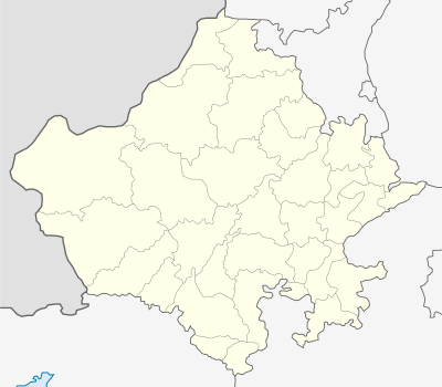
 Moonpur Thakran  Moonpur Thakran Location in Rajasthan, India | |
| Coordinates: 28°02′N 76°43′E / 28.03°N 76.72°ECoordinates: 28°02′N 76°43′E / 28.03°N 76.72°E | |
| Country |
|
| State | Rajasthan |
| District | Alwar |
| Elevation | 263 m (863 ft) |
| Languages | |
| Time zone | IST (UTC+5:30) |
| PIN | 301702 |
| Telephone code | 01460 |
| Vehicle registration | RJ-02 |
| Sex ratio | ♂/♀ |
| Website |
alwar |
Moonpur Thakran (Hindi : मूनपुर ठाकरान)is a village in Kotkasim tehsil Alwar district in the state of Rajasthan, India.
Location
Moonpur Thakran is located in the National Capital Region, 130 kilometres south of Delhi, 145 kilometres north of state capital Jaipur, 60 kilometres north of Alwar city, 30 kilometres east of Rewari city, 25 kilometres south of Dharuhera, 25 kilometres south of Bhiwadi and 22 kilometres west of Tijara, 20 kilometres north Kishangarh Bas, 5 kilometres south of Kotkasim, 4 kilometres north of Bibirani, another town in Alwar district.
Villages near Moonpur Thakran are Pur(1 km), Khanpur Dagran(1 km), Gheekaka(2 km), Sanoda Ahir(1 km), Jalaka(0.7 km).[1]
References
- ↑ "Kotkasim Tehsil | Kotkasim Tehsil map". www.onefivenine.com. Retrieved 2016-06-29.
This article is issued from Wikipedia - version of the 12/4/2016. The text is available under the Creative Commons Attribution/Share Alike but additional terms may apply for the media files.