Mont Avril
| Mont Avril | |
|---|---|
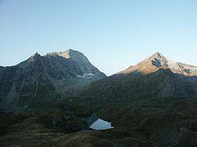
 Mont Gelé (left) and Mont Avril (right) from the north side | |
| Highest point | |
| Elevation | 3,347 m (10,981 ft) |
| Prominence | 158 m (518 ft) [1] |
| Parent peak | Grand Combin |
| Coordinates | 45°54′55″N 7°20′40″E / 45.91528°N 7.34444°ECoordinates: 45°54′55″N 7°20′40″E / 45.91528°N 7.34444°E |
| Geography | |
 Mont Avril Location in the Alps | |
| Location | Valais, Switzerland/Aosta Valley, Italy |
| Parent range | Pennine Alps |
Mont Avril is a mountain of the Pennine Alps, located on the Swiss-Italian border. Its summit has an elevation of 3,347 metres above sea level and can be reached by a trail from the Fenêtre de Durand (2,800 m).
References
External links
This article is issued from Wikipedia - version of the 1/3/2016. The text is available under the Creative Commons Attribution/Share Alike but additional terms may apply for the media files.