Monastery of Martyrius

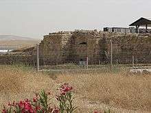
Monastery of Martyrius, now located in the centre of the Israeli settlement and city of Ma'ale Adumim, on the West Bank, was one of the most important centres of monastic life in the Judean Desert during the Byzantine period.[1][2]
History


The Palestine Exploration Fund's Survey of Western Palestine visited and measured up Khurbet el Murussus[3] in 1874. They described it as:
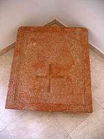
A ruined monastery with a chapel, the foundations only remaining. The building has a total measure of 270 feet east and west on a line 86° west. The width north and south is about 90 feet. The chapel to the east has three apses. The nave 18 feet 3 inches diameter, the aisles 15 feet 6 inches. The length inside from the back of the apse is 64 feet. The northern aisle is almost entirely destroyed. Remains of tesselated pavement occur on the floor of the southern aisle. The chapel has an atrium on the west and narrow cloisters on the north and south. In the latter is a well. A tower of later date (Shunet Murussus) has been built in the south-west corner of the building, and to the south of this are remains of the cobble-pavement (whence the place is named), in a courtyard the eastern wall of which is visible. The tesselated pavement of the chapel has a simple pattern, red, white, blue and black. West of the building there is a cistern mouth with an octagonal cover, 6 feet 4 inches diameter, or 2 feet side. The Maltese cross is cut on each side of this octagon. The cover may perhaps have been originally a font removed from its proper place. The cistern beneath is of considerable extent, and has to the north another entrance, with steps leading down. A water-channel runs some 10 yards south-west to a small reservoir, about 10 feet square, which was fed from the larger cistern. One of the stones in the building was measured and found to be 3 feet 1 inch long, 1 foot 5 inches high, 2 feet 2 inches thick. The stones in the tower are older material used up; one had a cross, in a lozenge and square, cut on it. The ruin stands on a hill 500 feet above the valleys, and there are traces of a considerable site and other cisterns of good size. Between the ruin and Khurbet ed Dikki there is a rude erection which looks almost like a dolmen. Two slabs rest on others, and below there is a small semicircular platform of unhewn stones, and lower down a small natural cave."[4]
In 1982-1985, the remains of the Monastery of Martyrius (Khirbet Murassas) were uncovered on a hill overlooking the road from Jericho to Jerusalem.[5] Martyrius was born in Cappadocia (present-day Turkey). After spending some time at the Laura of Euthymius in 457 CE, he lived as a hermit in a nearby cave. Later, he served as a priest at the Church of the Holy Sepulcher, and became Patriarch of Jerusalem (478-486 CE). It is believed that he built the monastery bearing his name at this time.[6]
The xenodocheion (pilgrim hostelry) was a source of considerable income to the Sabaite monks of the coenobium (Sabaite meaning "from the Great Lavra of Saint Sabbas the Sanctified").[7]
Archeological findings
The square-shaped compound of the monastery covers an area of 2.5 acres (10,000 m2). It is surrounded by walls preserved to a height of two meters. The gate was located in the eastern wall. A round rolling-stone, 2.5 meters in diameter, was found inside the gate, probably for additional protection. Numerous rock-cut cisterns and canals were found for collecting and channelling rainwater into cisterns.[6]
The monastery was built around a large courtyard and included a church, several chapels, a refectory, a kitchen, a storeroom, a bathhouse, residential quarters and an animal pen. Outside the wall was a pilgrims hostel.[6]
The main church was paved with colorful mosaics in geometric patterns interspersed with pictures of animals. A Greek inscription mentions the abbots Genesius and Iohannes.[6]
On the northern side of the complex is a cave in which several skeletons were found. A Greek inscription cites the names of three priests buried there. It is believed this is the cave where Martyrius lived before joining the church hierarchy in Jerusalem.[6]
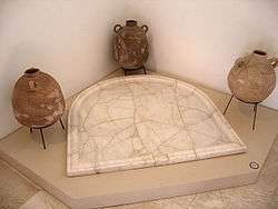
The refectory is surrounded by stone benches and divided by two rows of columns which supported a second story. The floor, discovered intact, is covered with mosaics in geometrical designs. The kitchen was also paved with mosaics and contained marble tables. Hundreds of ceramic vessels, cooking pots and wine cups were found there. The hostel provided guests with a chapel, sleeping quarters and a stable.[6]
The monastery was damaged during the Persian invasion in 614 CE and was abandoned after the Arab conquest in the mid-7th century.[6]
The site was excavated by Yitzhak Magen of the Israel Antiquities Authority.[6]
See also
References
- ↑ Murphy-O'Connor, Jerome (2008) The Holy Land: An Oxford Archaeological Guide from Earliest Times to 1700 Oxford University Press US, ISBN 0-19-923666-6 p 335
- ↑ Jericho Municipality Official Website Historical site
- ↑ meaning The ruin of the place of the rubble; probably from the pavement of cobble stones in the ruins, according to Palmer, 1881, p. 309
- ↑ Conder and Kitchener, 1883, SWP III, pp. 121-122, 165
- ↑ The Monastery of Martyrius at Ma'ale Adummim: A Guide, Yitzhak Magen, Israel Antiquities Authority, 1993
- 1 2 3 4 5 6 7 8 Jewish virtual library The Monastery of Martyrius
- ↑ Patrich Joseph (2001) The Sabaite Heritage in the Orthodox Church from the Fifth Century to the Present Peeters Publishers, ISBN 90-429-0976-5 p 319
Bibliography
- Conder, Claude Reignier; Kitchener, H. H. (1883). The Survey of Western Palestine: Memoirs of the Topography, Orography, Hydrography, and Archaeology. 3. London: Committee of the Palestine Exploration Fund.
- Palmer, E. H. (1881). The Survey of Western Palestine: Arabic and English Name Lists Collected During the Survey by Lieutenants Conder and Kitchener, R. E. Transliterated and Explained by E.H. Palmer. Committee of the Palestine Exploration Fund.
External sources
- SWP map 17, IAA, showing Khurbet el Murussus
- SWP map 17, Wikimedia commons
- Map showing location of monastery in Ma'ale Adumim (Hebrew) http://www.jr.co.il/ma/monast.htm
- BibleWalks.com article with pictures and plans
Coordinates: 31°46′45.05″N 35°18′01.14″E / 31.7791806°N 35.3003167°E