McHenry, Illinois
| McHenry | |
| City | |
| Nickname: The Heart Of The Fox | |
| Country | United States |
|---|---|
| State | Illinois |
| County | McHenry |
| Coordinates | 42°20′21″N 88°16′54″W / 42.33917°N 88.28167°WCoordinates: 42°20′21″N 88°16′54″W / 42.33917°N 88.28167°W |
| Area | 15.18 sq mi (39 km2) |
| - land | 14.74 sq mi (38 km2) |
| - water | 0.44 sq mi (1 km2) |
| Population | 26,992 (2010) |
| Density | 1,850.2/sq mi (714/km2) |
| Mayor | Susan E. Low |
| Timezone | CST (UTC-6) |
| - summer (DST) | CDT (UTC-5) |
| Postal code | 60050 and 60051 |
| Area code | 815 |
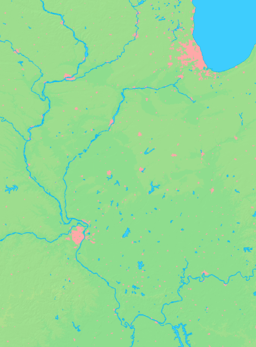
  Location of McHenry within Illinois | |
| Wikimedia Commons: McHenry, Illinois | |
| Website: www | |
McHenry is a city in McHenry County, Illinois, United States. The 2010 U.S. census reported its population at 26,992. McHenry was at one time the county seat of McHenry County, which once included adjoining Lake County to the east. McHenry took its name from McHenry County, which was named for Major William McHenry, an Indian fighter.[1]
McHenry is surrounded by natural lakes and streams, grassy moraine hills, gravel banks and shallow nutrient-rich peat bogs, remnants of receding glaciers from the last ice age. Moraine Hills State Park and Volo Bog State Natural Area preserve some of these unique natural features.
Geography
McHenry is located 60 miles northwest of Chicago in northern Illinois on the Fox River. According to the 2010 census, McHenry has a total area of 15.175 square miles (39.30 km2), of which 14.74 square miles (38.18 km2) (or 97.13%) is land and 0.435 square miles (1.13 km2) (or 2.87%) is water.[2] McHenry lies within the watershed of the Fox River, and its downtown area is situated on that river which is how it earned the nickname "The Heart of the Fox"..
Major streets
-
 Richmond Road/Elm Street/Front Street
 -
 Elm Street
 - Ringwood Road
- Ridge Road
- Curran Road
- Bull Valley Road
- McCullom Lake Road
- Crystal Lake Road
- Green Street
- Charles J Miller Road
- Chapel Hill Road
- River Road
- Draper Road
- Martin Road
- Riverside Drive
- Pearl Street
- Lincoln Road
- Dartmoor Drive
- Hollywood Blvd.
Demographics
| Historical population | |||
|---|---|---|---|
| Census | Pop. | %± | |
| 1880 | 874 | — | |
| 1890 | 979 | 12.0% | |
| 1900 | 1,013 | 3.5% | |
| 1910 | 1,031 | 1.8% | |
| 1920 | 1,146 | 11.2% | |
| 1930 | 1,354 | 18.2% | |
| 1940 | 1,596 | 17.9% | |
| 1950 | 2,080 | 30.3% | |
| 1960 | 3,336 | 60.4% | |
| 1970 | 6,772 | 103.0% | |
| 1980 | 10,737 | 58.5% | |
| 1990 | 16,177 | 50.7% | |
| 2000 | 21,501 | 32.9% | |
| 2010 | 26,992 | 25.5% | |
| Est. 2015 | 26,657 | [3] | −1.2% |
The population density was 1,850.2 per square mile (714.4/km²). There were 8,127 housing units at an average density of 699.4 per square mile (270.0/km²). The racial makeup of the city was 94.18% White, 0.35% African American, 0.21% Native American, 0.89% Asian, 0.04% Pacific Islander, 3.31% from other races, and 1.02% from two or more races. Hispanic or Latino of any race were 7.10% of the population.
There were 7,872 households of which 38.7% had children under the age of 18 living with them, 57.2% were married couples living together, 9.7% had a female householder with no husband present, and 29.4% were non-families. 24.7% of all households were made up of individuals and 9.9% had someone living alone who was 65 years of age or older. The average household size was 2.70 and the average family size was 3.25.
Age distribution was 28.5% under the age of 18, 7.8% from 18 to 24, 32.7% from 25 to 44, 19.9% from 45 to 64, and 11.0% who were 65 years of age or older. The median age was 34 years. For every 100 females there were 94.8 males. For every 100 females age 18 and over, there were 91.2 males.
The median household income was $55,759, and the median family income was $66,040. Males had a median income of $46,552 versus $29,808 for females. The per capita income for the city was $23,272. About 3.8% of families and 4.6% of the population were below the poverty line, including 6.1% of those under age 18 and 2.6% of those age 65 or over.
Economy
Major industrial users including Medela, Follett School Solutions, Fabrik Industries and Plaspros have located in the city's business parks. Centegra Hospital - McHenry provides emergency and in and out-patient health care services to the city and surrounding areas. Steady residential growth has resulted in significant commercial development. The north Richmond Road corridor has become a destination for shoppers in the northern Illinois and southern Wisconsin areas with numerous "big box" retailers and smaller chains.
Transportation
McHenry is currently the terminus of a branch line on Metra's Union Pacific/Northwest Line, with daily passenger service to Ogilvie Transportation Center (Northwestern Station) in downtown Chicago.[5] The line that now terminates at McHenry once continued to Williams Bay, Wisconsin, but that service was discontinued in stages in the 1960s and 1970s.
Notable people
- Gary Adams (d. 2000), founded TaylorMade Golf in McHenry in 1979[6][7]
- John Brzenk (b. 1964), world champion armwrestler.
- Rob Doran (b. 1976), original bassist of the rock band Alkaline Trio.
- Jason Faunt (b. 1974), actor, grew up in McHenry
- Jace Sayler (b. 1979), football player with the New England Patriots (Super Bowl champion), attended McHenry High School (West Campus)
- Matt Skiba (b. 1976), Co-lead singer and guitarist for the rock bands Blink-182 and Alkaline Trio.
- Mariann Mayberry (b. 1965), member of Steppenwolf Theatre Company, lived in McHenry and graduated from McHenry High School (West Campus)
References
- ↑ Chicago and North Western Railway Company (1908). A History of the Origin of the Place Names Connected with the Chicago & North Western and Chicago, St. Paul, Minneapolis & Omaha Railways. p. 100.
- ↑ "G001 - Geographic Identifiers - 2010 Census Summary File 1". United States Census Bureau. Retrieved 2015-12-27.
- ↑ "Annual Estimates of the Resident Population for Incorporated Places: April 1, 2010 to July 1, 2015". Retrieved July 2, 2016.
- ↑ "Census of Population and Housing". Census.gov. Archived from the original on 11 May 2015. Retrieved June 4, 2015.
- ↑ Union Pacific / Northwest (UP-NW) Line Map
- ↑ Dodson, James (May–June 1998). "Ace of Clubs". Departures Magazine. American Express Publishing Corporation. Retrieved 31 August 2009.
- ↑ Wyss, Cyndi (15 May 2009). "Wyss: Economic uptick good, but bears price". Northwest Herald. Retrieved 31 August 2009.

