Matanikau River
| Matanikau | |
| River | |
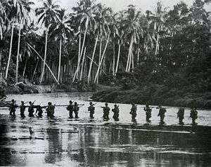
 A U.S. Marine patrol crosses the Matanikau River on Guadalcanal in September 1942 | |
| Country | Solomon Islands |
|---|---|
| Source | |
| - location | Guadalcanal |
| Mouth | |
| - location | Savo Sound |
The Matanikau River of Guadalcanal, Solomon Islands, is located in the northwest part of the island. During the World War II Guadalcanal campaign, several significant engagements occurred between United States and Japanese forces near the river.
References
| Wikimedia Commons has media related to Matanikau River. |
- "Matanikau River". La Tierra (in Spanish). www.tutiempo.net. 1993. Retrieved 2007-01-26.
- Anderson, Charles R. (1993). "GUADALCANAL" (brochure). The U.S. Army Campaigns of World War II. United States Army Center of Military History. Retrieved 2006-07-09.
- Cagney, James (2005). "The Battle for Guadalcanal" (javascript). HistoryAnimated.com. Retrieved 2006-05-17.- Interactive animation of the battle
- Chen, C. Peter (2004–2006). "Guadalcanal Campaign". World War II Database. Retrieved 2006-05-17.
- Flahavin, Peter (2004). "Guadalcanal Battle Sites, 1942-2004". Retrieved 2006-08-02.- Web site with many pictures of Guadalcanal battle sites from 1942 and how they look now.
- Hoffman, Jon T. (1995). "Matanikau" (brochure). FROM MAKIN TO BOUGAINVILLE: Marine Raiders in the Pacific War. Marine Corps Historical Center. Retrieved 2006-12-28.
- Hough, Frank O.; Ludwig, Verle E., and Shaw, Henry I., Jr. "Pearl Harbor to Guadalcanal". History of U.S. Marine Corps Operations in World War II. Retrieved 2006-05-16. Cite uses deprecated parameter
|coauthors=(help) - Miller, John Jr. (1949). "GUADALCANAL: THE FIRST OFFENSIVE". UNITED STATES ARMY IN WORLD WAR II. United States Army Center of Military History. Retrieved 2006-07-04.
- Shaw, Henry I. (1992). "First Offensive: The Marine Campaign For Guadalcanal". Marines in World War II Commemorative Series. Retrieved 2006-07-25.
- Zimmerman, John L. (1949). "The Guadalcanal Campaign". Marines in World War II Historical Monograph. Retrieved 2006-07-04.
Coordinates: 9°26′5″S 159°58′1″E / 9.43472°S 159.96694°E
This article is issued from Wikipedia - version of the 7/3/2016. The text is available under the Creative Commons Attribution/Share Alike but additional terms may apply for the media files.