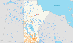
Manitoba Provincial Road 280
| ||||
|---|---|---|---|---|
 | ||||
| Route information | ||||
| Maintained by Manitoba Infrastructure and Transportation | ||||
| Length: | 291.00 km[1] (180.82 mi) | |||
| Existed: | 1987[2] – present | |||
| Major junctions | ||||
| West end: |
| |||
|
| ||||
| East end: | Butnau Road in Gillam | |||
| Highway system | ||||
| ||||
Provincial Road 280 (PR 280) is a road in the Canadian province of Manitoba. It runs from PR 391 northwest of Thompson to local streets in Gillam. The route is 291 kilometres (181 mi) long, which during its length, passes several large lakes and intersects with one provincial road, PR 290, just north of Gillam. The route is very scenic, passing through dense forests and rural lands. The route supplies three municipalities, Thompson, Split Lake, and Gillam. From its terminus north of Thompson, Manitoba to the town Gillam, PR 280 is classified as a Class A1 Provincial Route.[3]
PR 280 was designated in 1987 as a connector from Thompson to Gillam with a spur to Sundance.
Route description
PR 280 begins at an intersection north of Thompson on the shores of Birch Tree Lake with PR 391. PR 280 runs northeast from PR 391 as a two-lane gravel road through the dense woods north of Thompson Airport. As the road bends to the northeast, it runs west of Mystery Lake, which is connected by a gravel road that runs to the shoreline. Continuing northeast, PR 280 leaves the Mystery Lake area and soon reaches a dirt road that connects to nearby Moak Lake.[1]
After Moak Lake, PR 280 continues northeast past Wasakamew Lake and Orr Lake while paralleling the Burntwood River. After Putkawakan Lake, PR 280 turns eastward along the Burntwood River, which soon drains into Split Lake. The road turns northeast away from the river and runs into a junction with a winter road that connects to the settlement of Split Lake. Paralleling the north shore of eponymous lake, PR 280 runs to the northeast from Split Lake and starts wandering through the dense woods of northern Manitoba.[1]
Approaching the western end of Stephens Lake, PR 280 turns east and soon to the southeast as it reaches the northern shore of the lake. Passing a local connector to the shore, the route reaches a junction with the southern terminus of PR 290, which connects to the abandoned settlement of Sundance. At this junction, PR 280 turns west, reaching the shores of the Nelson River. The route crosses over the Nelson River and reaches the settlement of Long Spruce.[1]
After Long Spruce, PR 280 runs west along the southern shore of the Nelson River then turns south and southwest away from the river. The route winds west, then turns to the northwest, approaching the river and Stephens Lake. Paralleling railroad tracks, PR 280 passes an electrical substation as it enters the city of Gillam. Through the northeastern section of Gillam, the route crosses over the railroad tracks and turn north and west in short order. Running southwest, PR 280 reaches the access point to Gillam Airport and soon enters downtown Gillam.[1]
Through downtown Gillam, PR 280 reaches a junction with Batnau Road, which marks the eastern terminus of the highway. Batnau Road connects to downtown Gillam.[1]
History
Before PR 280 existed, the only ways to the northern terminus town of Gillam was via a nearby airport to the southeast of town and the railroad line that stretched from Thompson to northern parts of Manitoba.[4] The railroad opened in 1929.[5] PR 280 was designated by the Manitoba Ministry of Infrastructure and Transportation in 1987 as a designated gravel road from PR 391 northwest of Thompson to Gillam with an unnumbered spur to Sundance.[2] PR 290 was designated on the spur in 1989.[6]
On March 28, 2002, the government of Manitoba order out an CAD$84.8 million plan to work on its province's roads.[7] $940,000 was spent for gravel stabilization beginning at PR 391 and ending in Gillam. This work was also under the Community Main Access Gravel Road Stabilization Program. $700,000 of this $84 million went for additional gravel between 391 and PR 290. $600,000 went to road development near Wasakamew Lake, 52 kilometres (32 mi) north of PR 391.[7]
Junction list
| Division | Location | km[1] | mi | Destinations | Notes |
|---|---|---|---|---|---|
| No. 22 | Thompson | 0 | 0.0 | ||
| No. 23 | Jacam | 260 | 160 | ||
| Gillam | 291 | 181 | Butnau Road | ||
| 1.000 mi = 1.609 km; 1.000 km = 0.621 mi | |||||
See also
References
- 1 2 3 4 5 6 7 Google (August 3, 2015). "overview map of PR 280" (Map). Google Maps. Google. Retrieved August 3, 2015.
- 1 2 Manitoba Highway Map (PDF) (Map). Manitoba Minister of Infrastructure and Transportation. 1987. Retrieved March 5, 2015.
- ↑ "Manitoba Highway Classification System". Manitoba Minister of Infrastructure and Transportation. 2015. Retrieved August 3, 2015.
- ↑ "Map of Manitoba - Part 13" (PDF). Manitoba Ministry of Infrastructure and Transportation. Retrieved March 31, 2008.
- ↑ Government of Manitoba (2008). "Town of Gillam Community Profile". Archived from the original on March 12, 2008. Retrieved April 3, 2008.
- ↑ Manitoba Highway Map (PDF) (Map). Manitoba Minister of Infrastructure and Transportation. 1989. Retrieved March 5, 2015.
- 1 2 "ASHTON OUTLINES HIGHWAYS PROGRAM LIST TO ASSIST INDUSTRY IN PLANNING FOR UPCOMING CONSTRUCTION SEASON". Government of Manitoba. Retrieved 2007-05-11.
External links
