Makatumbe Front Range Lighthouse
 Tanzania | |
| Location | Dar es Salaam, Tanzania |
|---|---|
| Coordinates | 6°47′43.8″S 39°19′53.4″E / 6.795500°S 39.331500°ECoordinates: 6°47′43.8″S 39°19′53.4″E / 6.795500°S 39.331500°E |
| Tower shape | Metal tower |
| Markings / pattern | Square platform |
| Height | 15 metres (49 ft) |
| Focal height | 15 metres (49 ft) |
| Characteristic | FI. 1 |
| Admiralty number | D6673 |
| NGA number | 31431[1] |
| Managing agent | Tanzania Ports Authority |
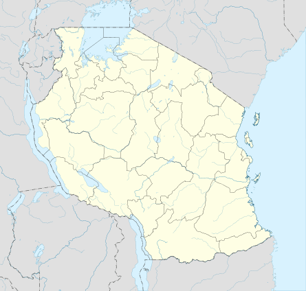
The Makatumbe Front Range Lighthouse (also known as Dar es Salaam Bay Range Front or Inner Makatumbe lighthouse) is located on the island of Inner Makatumbe close to the coast of Dar es salaam, Tanzania and South-West of the island of Outer Makatumbe. The lighthouse works in conjuction with the Makatumbe RR and assists ships entering the Kivukoni channel.[2]
The lighthouse is not really located on the island of Inner Makatumbe but just north of the coast of the island. The lighthouse is metal structure mounted on a square platform with a triangular day mark.
References
- ↑ Ras Kasone The Lighthouse Directory. University of North Carolina at Chapel Hill. Retrieved April 18, 2016
- ↑ Office, United States Hydrographic (1916-01-01). Africa Pilot: South and east coasts of Africa from Cape of Good Hope to Ras Hafun. Hydrographic office under the authority of the secretary of the navy.
External links
This article is issued from Wikipedia - version of the 10/26/2016. The text is available under the Creative Commons Attribution/Share Alike but additional terms may apply for the media files.