Main Street Historic District (Hendersonville, North Carolina)
|
Main Street Historic District | |
|
Historic Hendersonville, September 2014 | |
  | |
| Location | Main St. between Sixth Ave. East and First Ave. East; Roughly N. Main St., Second Ave. W, W. Allen St., N. Washington and First Ave. E., Hendersonville, North Carolina |
|---|---|
| Coordinates | 35°18′59″N 82°27′37″W / 35.31639°N 82.46028°WCoordinates: 35°18′59″N 82°27′37″W / 35.31639°N 82.46028°W |
| Area | 34 acres (14 ha) |
| Built | 1850 |
| Architect | Smith, Richard Sharpe; Stilwell, Erle |
| Architectural style | Classical Revival, Chicago, Commercial Style |
| MPS | Hendersonville MPS |
| NRHP Reference # | 89000028, 06001140 (Boundary Increase)[1] |
| Added to NRHP | March 30, 1989, December 20, 2006 (Boundary Increase) |
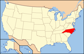
Main Street Historic District is a national historic district located at Hendersonville, Henderson County, North Carolina. The district encompasses 65 contributing buildings in the central business district of Hendersonville. The commercial and governmental buildings include notable examples of Classical Revival architecture. Located in the district is the separately listed Henderson County Courthouse. Other notable buildings include the Huggins Building (c. 1850), Cole Bank Building (c. 1880), Justus Pharmacy, Davis Store block (1900), The Federal Building (1914), Maxwell Store Building (c. 1910), Pace’s Market (c. 1925), J. C. Penney Building (1939), and Lampley Motors (c. 1945).[2][3]
It was listed on the National Register of Historic Places in 1989, with a boundary increase in 2006.[1]
References
- 1 2 National Park Service (2010-07-09). "National Register Information System". National Register of Historic Places. National Park Service.
- ↑ Sybil Argintar Bowers and Martha Fullington (1987–1988). "Main Street Historic District" (pdf). National Register of Historic Places - Nomination and Inventory. North Carolina State Historic Preservation Office. Retrieved 2015-01-01.
- ↑ Sybil Argintar Bowers (March 2006). "Main Street Historic District Boundary Increase and Additional Documentation" (pdf). National Register of Historic Places - Nomination and Inventory. North Carolina State Historic Preservation Office. Retrieved 2015-01-01.


