Lower Heyford
| Lower Heyford | |
| St Mary's parish church |
|
 Lower Heyford |
|
| Area | 7.14 km2 (2.76 sq mi) |
|---|---|
| Population | 492 (parish, including Caulcott) (2011 Census) |
| – density | 69/km2 (180/sq mi) |
| OS grid reference | SP4824 |
| Civil parish | Lower Heyford |
| District | Cherwell |
| Shire county | Oxfordshire |
| Region | South East |
| Country | England |
| Sovereign state | United Kingdom |
| Post town | Bicester |
| Postcode district | OX25 |
| Dialling code | 01869 |
| Police | Thames Valley |
| Fire | Oxfordshire |
| Ambulance | South Central |
| EU Parliament | South East England |
| UK Parliament | Banbury |
| Website | Lower Heyford and Caulcott |
|
|
Coordinates: 51°55′12″N 1°17′42″W / 51.920°N 1.295°W
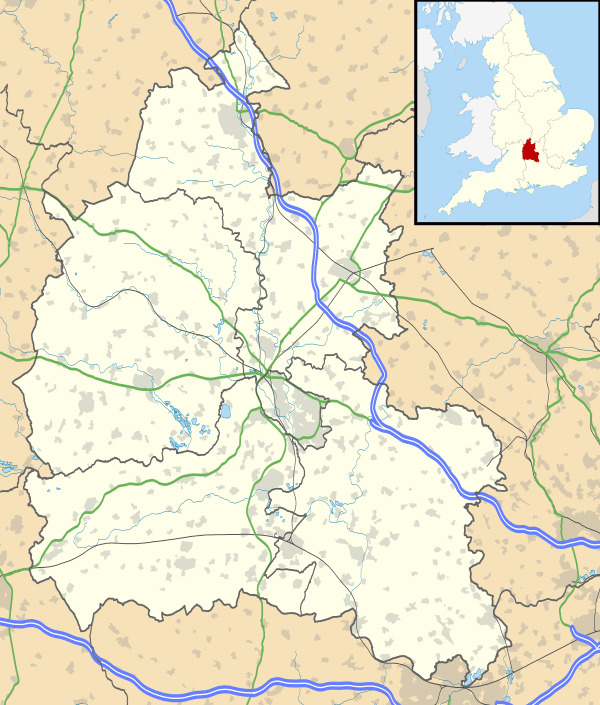
Lower Heyford is a village and civil parish beside the River Cherwell in Oxfordshire, about 6 miles (10 km) west of Bicester. The 2011 Census recorded the parish's population as 495.[1]
Prehistory
Aves ditch is pre-Anglo-Saxon and may have been dug as a boundary ditch. It still forms the eastern boundary of the parish.
Harborough Bank, an Anglo-Saxon burial mound southwest of the village dates from the 6th century.[2]
Manor
The Domesday Book of 1086 records the village as Hegford. The toponym evolved as Heiford until the middle of the 13th century, Heyford ad Pontem after the bridge was built (see below), Heyford Purcell since the middle of the 14th century, Nether Heyford after 1474 and sometimes Little Heyford. Some of these names were used concurrently.[3] "Lower" distinguishes it from Upper Heyford which is about 1 mile (1.6 km) upstream along the Cherwell valley. There are both a Nether Heyford and a Little Heyford in Northamptonshire, so the current "Lower Heyford" reduces confusion.
Before the Norman Conquest of England the manor of Lower Heyford belonged to Edwin, the son of a Saxon thegn. William the Conqueror granted the land to the powerful Geoffrey de Montbray, bishop of Coutances. The manor passed through various hands until 1533 when Sir Edward Baynton sold it to Corpus Christi College, Oxford. Corpus Christi College still owned the estate in the 1950s.[2]
Church and chapel
Wufwig, Bishop of Dorchester consecrated a parish church at Lower Heyford in the 11th century.[2] The current Church of England parish church of Saint Mary was built in the 13th century, and rebuilt in the Decorated Gothic style in the first half of the 14th century. The Perpendicular Gothic clerestory and south porch were added later.[4] The building was restored in 1867–68.[5]
In the reign of Edward VI the church tower had a ring of four bells.[5] It now has a ring of six, of which the second and fourth were cast in 1766 by Matthew III Bagley[6] of Chacombe, Northamptonshire.[7] W&J Taylor cast the fifth bell in 1825, presumably at their then foundry in Oxford.[7] Mears and Stainbank of the Whitechapel Bell Foundry cast the tenor bell in 1867[6] and the treble and third bells in 1925.[6]
The church is said to have had a 17th-century clock that was made in 1695 and removed during its Victorian restoration.[5]
St Mary's is now part of the Benefice of Cherwell Valley along with five other parishes: Ardley, Fritwell, Somerton, Souldern and Upper Heyford.[8]
In the latter part of the 17th century Lower Heyford had also a Quaker congregation. Lower Heyford had a Methodist congregation by 1804, which soon had a chapel in the village and eventually became part of the United Methodist Church. A new chapel was built in 1906, was still used for worship in 1955 but is now a private house.[2]
Economic and social history


In the Middle Ages Lower and Upper Heyford had two watermills on the River Cherwell, and one was still in use in 1858.[2]
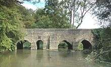
There has been a bridge over the River Cherwell between Lower Heyford, Rousham and Steeple Aston since at least 1255.[2] The present bridge has nine arches and was noted by the early 16th-century antiquary John Leland.[9] In the 1970s Jennifer Sherwood dated part of it to the 13th century, and its north side to either the 15th or 16th century.[10] However, English Heritage dates the earliest parts of the present bridge to the 14th century, its alterations to the 17th century and its widening to the 19th century.[11] The bridge is a Grade II* listed building and forms an important part of the view from the historic adjacent landscape garden of Rousham House.[11]
The stretch of the Oxford Canal between Banbury and Tackley was completed in 1787.[12] It runs along the Cherwell valley and bounds Lower Heyford village on its north and west sides. Coal mined in Leicestershire and Warwickshire was unloaded on Heyford Wharf at Lower Heyford.
An open field system of farming continued in the parish until 1802 when a land award from a Parliamentary Inclosure Act for the parish was made.[2]
In 1797 the road between Bicester and Enstone was made into a turnpike.[2] Lower Heyford had two toll-gates: one at Heyford Bridge and the other at the east end of the village.[3] The road was disturnpiked in 1876, is now the B4030 road and Heyford Bridge continues to carry its traffic.
Heyford Wharf sent coal via the turnpike road to Bicester until 1850, when the Buckinghamshire Railway linked Bicester Town to Bletchley on the London and North Western Railway.[13]
Construction of the Oxford and Rugby Railway between Oxford and Banbury began in 1845. By the time the line opened the Great Western Railway had taken it over. In Lower Heyford the railway runs parallel with the canal on the west side. The GWR opened Heyford railway station at Lower Heyford in 1850.[3] The route is now the Cherwell Valley Line and Heyford station is served by First Great Western trains.
In 1808 Lower Heyford had two dame schools, and by 1833 there were three more formal schools. A National School was opened in 1867. In a reorganisation of schools in 1932, the National School became a junior school and senior pupils from Lower Heyford had to go to Steeple Aston. Lower Heyford school became a Church of England controlled school in 1952.[2] It closed in 1974[14] and is now a private house.
Amenities
The Bell Inn is a 17th-century building that has been a public house since at least 1819[2] and remains so today.
The Heyfords Women's Institute serves both Lower and Upper Heyford.[15]
In 2000 Lower Heyford Cricket Club was the champion of Oxfordshire Cricket Association League Division Four.[16]
Heyford Athletic Football Club was formed in 1950 when its founders separated from Heyford United in Upper Heyford.
References
- ↑ "Area: Lower Heyford (Parish): Key Figures for 2011 Census: Key Statistics". Neighbourhood Statistics. Office for National Statistics. Retrieved 24 August 2015.
- 1 2 3 4 5 6 7 8 9 10 Lobel 1959, pp. 182–195.
- 1 2 3 "Parish History". Lower Heyford Parish Council. Archived from the original on 12 February 2009.
- ↑ Sherwood & Pevsner 1974, pp. 692–693.
- 1 2 3 Beeson & Simcock 1989, p. 42.
- 1 2 3 Davies, Peter (24 July 2007). "Lower Heyford S Mary". Dove's Guide for Church Bell Ringers. Central Council of Church Bell Ringers. Retrieved 9 August 2011.
- 1 2 Dovemaster (25 June 2010). "Bell Founders". Dove's Guide for Church Bell Ringers. Central Council of Church Bell Ringers. Retrieved 9 August 2011.
- ↑ Archbishops' Council. "Benefice of Cherwell Valley". A Church Near You. Church of England. Retrieved 24 August 2015.
- ↑ Jervoise 1932, p. 153.
- ↑ Sherwood & Pevsner 1974, p. 693.
- 1 2 Historic England. "Heyford Bridge that part in the parish of Lower Heyford (1266350)". National Heritage List for England. Retrieved 11 August 2011.
- ↑ Compton 1976, p. 37.
- ↑ Compton 1976, p. 117.
- ↑ "Lower Heyford Church of England National School". The National Archives.
- ↑ "Your Nearest WI". Oxfordshire Federation of Women's Institutes. Retrieved 24 August 2015.
- ↑ "Previous Winners of the League". Oxfordshire Cricket Association.
Sources and further reading
- Beeson, C.F.C. (1989) [1962]. Simcock, A.V., ed. Clockmaking in Oxfordshire 1400–1850 (3rd ed.). Oxford: Museum of the History of Science. p. 42. ISBN 0-903364-06-9.
- Blomfield, James Charles (1892). Part VI: History of Upper and Lower Heyford. Deanery of Bicester. Elliot Stock & Co: London.
- Compton, Hugh J (1976). The Oxford Canal. Newton Abbot: David & Charles. pp. 37, 117. ISBN 0-7153-7238-6.
- Jervoise, Edwyn (1932). The Ancient Bridges of Mid and Eastern England. III. Westminster: The Architectural Press for the SPAB. p. 153.
- Lobel, Mary D, ed. (1959). A History of the County of Oxford. Victoria County History. 6: Ploughley Hundred. London: Oxford University Press for the Institute of Historical Research. pp. 182–195.
- Sherwood, Jennifer; Pevsner, Nikolaus (1974). Oxfordshire. The Buildings of England. Harmondsworth: Penguin Books. pp. 692–693. ISBN 0-14-071045-0.
External links
| Wikimedia Commons has media related to Lower Heyford. |
