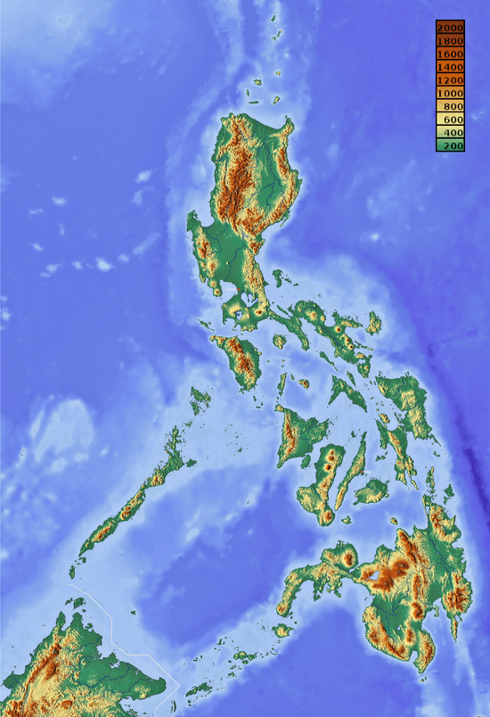
List of potentially active volcanoes in the Philippines
For mountains which include those classified as potentially-active volcanoes, see List of mountains in the Philippines. For active and inactive Philippine volcanoes, see List of active volcanoes in the Philippines and List of inactive volcanoes in the Philippines.
This is a list of potentially active volcanoes in the Philippines, as classified by the Philippine Institute of Volcanology and Seismology.
Luzon
| Name | Elevation (ASL) | Last eruption | Coordinates | |
|---|---|---|---|---|
| m | ft | |||
| Amorong | 376 | 1,234 | — | 15°49′41″N 120°48′18″E / 15.828°N 120.805°E |
| Arayat | 1,026 | 3,366 | Holocene | 15°12′00″N 120°44′31″E / 15.20°N 120.742°E |
| Isarog | 1,966 | 6,450 | — | 13°39′29″N 123°22′48″E / 13.658°N 123.38°E |
| Labo | 943 | 3,094 | 27,000 BP | 14°01′12″N 122°47′31″E / 14.02°N 122.792°E |
| Laguna Caldera | 743 | 2,438 | 28,000 BP | 14°25′N 121°16′E / 14.42°N 121.27°E |
| Malinao | 1,548 | 5,079 | 60,000 BP | 13°25′19″N 123°35′49″E / 13.422°N 123.597°E |
| Malindig | 1,157 | 3,796 | — | 13°14′24″N 122°01′05″E / 13.240°N 122.018°E |
| Mariveles | 1,388 | 4,554 | 4000 BP | 14°31′N 120°28′E / 14.52°N 120.47°E |
| Natib | 1,287 | 4,222 | Holocene | 14°42′18″N 120°24′00″E / 14.705°N 120.40°E |
| Panay | 501 | 1,644 | Pleistocene | 13°43′23″N 120°53′35″E / 13.723°N 120.893°E |
| San Cristobal | 14°04′N 121°26′E / 14.067°N 121.433°E | |||
| Santo Tomas | 2,260 | 7,410 | — | 16°20′N 120°33′E / 16.33°N 120.55°E |
Visayas
| Name | Elevation (ASL) | Last eruption | Coordinates | |
|---|---|---|---|---|
| m | ft | |||
| Cabalian | 945 | 3,100 | — | 10°17′13″N 125°13′16″E / 10.287°N 125.221°E |
| Cancajanag | 900 | 3,000 | — | 10°24′43″N 124°31′55″E / 10.412°N 124.532°E |
| Cuernos de Negros | 1,862 | 6,109 | 12,000 BC | 9°15′29″N 123°10′30″E / 9.258°N 123.175°E |
| Mahagnao | 800 | 2,600 | 10°52′19″N 124°51′11″E / 10.872°N 124.853°E | |
| Mandalagan | 1,879 | 6,165 | Holocene | 10°39′N 123°15′E / 10.65°N 123.25°E |
| Silay | 1,535 | 5,036 | Holocene | 10°46′N 123°14′E / 10.77°N 123.23°E |
Mindanao
Apo in Davao del Sur
| Name | Elevation (ASL) | Last eruption | Coordinates | |
|---|---|---|---|---|
| m | ft | |||
| Apo | 2,954 | 9,692 | — | 7°00′29″N 125°16′12″E / 7.008°N 125.27°E |
| Balatukan | 2,450 | 8,040 | — | 8°46′N 124°59′E / 8.77°N 124.98°E |
| Balut | 852 | 2,795 | Holocene | 5°24′00″N 125°22′30″E / 5.40°N 125.375°E |
| Camiguin Mindanao | 1,332 | 4,370 | Holocene | 9°06′N 124°42′E / 9.1°N 124.7°E |
| Kalatungan | 2,824 | 9,265 | Holocene | 7°57′N 124°48′E / 7.95°N 124.80°E |
| Latukan | 2,158 | 7,080 | Holocene | 7°39′N 124°28′E / 7.65°N 124.47°E |
Sulu Archipelago
| Name | Elevation (ASL) | Last eruption | Coordinates | |
|---|---|---|---|---|
| m | ft | |||
| Dakut | 474 | 1,555 | 5°26′N 120°34′E / 5.44°N 120.56°E | |
See also
- List of active volcanoes in the Philippines
- List of inactive volcanoes in the Philippines
- List of mountains in the Philippines
- Philippine Institute of Volcanology and Seismology
- Pacific Ring of Fire
References
- Philippine Institute of Volcanology and Seismology (PHIVOLCS) Potentially Active Volcano list
- Philippine Institute of Volcanology and Seismology (PHIVOLCS) Active Volcano list
- Philippine Institute of Volcanology and Seismology (PHIVOLCS) Inactive Volcano list
External links
-
 Media related to Volcanoes of the Philippines at Wikimedia Commons
 - Siebert L, Simkin T (2002-). Volcanoes of the World: an Illustrated Catalog of Holocene Volcanoes and their Eruptions. Smithsonian Institution, Global Volcanism Program Digital Information Series, GVP-3, (http://www.volcano.si.edu).
This article is issued from Wikipedia - version of the 11/24/2016. The text is available under the Creative Commons Attribution/Share Alike but additional terms may apply for the media files.
