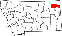
List of mountains in Roosevelt County, Montana
This list is incomplete; you can help by expanding it.
There are at least 9 named mountains in Roosevelt County, Montana.
- Bears Nest, 48°26′49″N 105°28′41″W / 48.44694°N 105.47806°W, el. 2,657 feet (810 m)[1]
- Castle Rock, 48°29′21″N 105°36′33″W / 48.48917°N 105.60917°W, el. 2,756 feet (840 m)[2]
- Chris Hill, 48°31′12″N 105°06′29″W / 48.52000°N 105.10806°W, el. 2,684 feet (818 m)[3]
- Clay Butte, 48°16′23″N 104°13′54″W / 48.27306°N 104.23167°W, el. 2,425 feet (739 m)[4]
- Snake Butte, 48°15′45″N 104°10′03″W / 48.26250°N 104.16750°W, el. 2,638 feet (804 m)[5]
- Square Butte, 48°30′47″N 105°13′21″W / 48.51306°N 105.22250°W, el. 2,572 feet (784 m)[6]
- Sugar Top Hill, 48°12′03″N 104°27′33″W / 48.20083°N 104.45917°W, el. 2,287 feet (697 m)[7]
- Twomile Hill, 48°08′11″N 104°57′43″W / 48.13639°N 104.96194°W, el. 2,021 feet (616 m)[8]
- Windy Butte, 48°25′11″N 105°20′08″W / 48.41972°N 105.33556°W, el. 2,539 feet (774 m)[9]
See also
Notes
- ↑ "Bears Nest". Geographic Names Information System. United States Geological Survey.
- ↑ "Castle Rock". Geographic Names Information System. United States Geological Survey.
- ↑ "Chris Hill". Geographic Names Information System. United States Geological Survey.
- ↑ "Clay Butte". Geographic Names Information System. United States Geological Survey.
- ↑ "Snake Butte". Geographic Names Information System. United States Geological Survey.
- ↑ "Square Butte". Geographic Names Information System. United States Geological Survey.
- ↑ "Sugar Top Hill". Geographic Names Information System. United States Geological Survey.
- ↑ "Twomile Hill". Geographic Names Information System. United States Geological Survey.
- ↑ "Windy Butte". Geographic Names Information System. United States Geological Survey.
This article is issued from Wikipedia - version of the 6/23/2011. The text is available under the Creative Commons Attribution/Share Alike but additional terms may apply for the media files.
