List of mountains and hills of the Eifel
This List of mountains and hills in the Eifel contains a selection of mountains (2000 feet or higher[1]) and hills (below 2000 feet) in the low mountain range of the Eifel which lies mainly in Germany but also crosses into Belgium. The Eifel is located predominantly in the German states of Rhineland-Palatinate and North Rhine-Westphalia and belongs to the Rhenish Massif.
- See also: List of mountains and hills in North Rhine-Westphalia and List of mountains and hills in Rhineland-Palatinate
| Elevation | Height (m) |
Eifel region(s) | District/ Province |
Remarks | Image |
| Hohe Acht | 746.9 | High Eifel | Ahrweiler, Mayen-Koblenz |
Highest elevation in the Eifel and the High Eifel; Type: volcano; site of the Kaiser Wilhelm Tower |
 |
| Ernstberg (also: Erresberg) |
698.8 | Vulkan Eifel | Vulkaneifel | Highest of the west Eifel volcanos; second highest mountain in the Eifel; Type: volcano |
 |
| unnamed peak? (Schwarzer Mann) |
699.1 | Vulkan Eifel | Vulkaneifel | Highest of the west Eifel volcanos; second highest mountain in the Eifel; Type: volcano |
 |
| Schwarzer Mann | 697.8 | Schnee Eifel, Schneifel |
Eifelkreis Bitburg-Prüm | Highest point of the Schneifel ridge and hence the Schnee Eifel |
 |
| Signal de Botrange | 694.24 | Hohes Venn | Liège (B) | Highest mountain in Belgium and the Hohes Venn |  |
| Weißer Stein | 693 | North Eifel, Zitter Forest |
Euskirchen | Highest mountain of the Zitter Forest and in North Rhine-Westphalia west of the Rhine; second highest mountain in Belgium; site of observation tower on the (German) eastern slopes of the mountain | 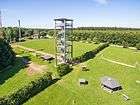 |
| Scharteberg | 691.4 | Vulkan Eifel | Vulkaneifel | Second highest elevation in the Vulkan Eifel, lies between Ernstberg and Nerother Kopf; site of transmission tower of SWR’s Eifel Transmitter |
 |
| Burgberg ("castle mountain") of the Nürburg |
676.5 | High Eifel | Ahrweiler | Second highest elevation in the High Eifel; Type: volcano; Located inside the Nordschleife of the old Nürburgring; site of Nürburg castle |
|
| Hochkelberg | 674.9 | High Eifel | Vulkaneifel | Third highest elevation in the High Eifel; Type: stratovolcano; Roman ringwork and modern transmission mast |
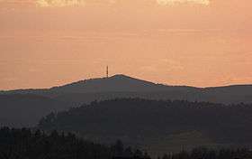 |
| Prümscheid | 674.7 | Vulkan Eifel | Vulkaneifel | Highest point of the ridge in the Salm Forest near Gerolstein | |
| Schöneberg | 670.2 | North Eifel | Ahrweiler |  | |
| Raßberg | 664.9 | High Eifel | Mayen-Koblenz | 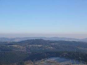 | |
| Bärbelkreuz | 662.8 | Zitterwald | Euskirchen | Nearby: Eifel-Bärbelkreuz Transmission Tower | 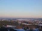 |
| Seimersberg | 662.9 | Schnee-Eifel | Eifelkreis Bitburg-Prüm | ||
| Pannensterzkopf (Bovel) | 662 | Hohes Venn | Liège (B) | ||
| Hühnerhöhe | 659.9 | North Eifel, Zitter Forest |
Euskirchen | ||
| Steling | 658.3 | Hohes Venn | Aachen (D), Liège (B) |
Highest mountain in the district of Aachen |  |
| Steinberg | 657.8 | Schneifel | Vulkaneifel | |
|
| Foltenhöhe | 656 | North Eifel | Landkreis Euskirchen | |
|
| Huppertsberg | 655.5 | North Eifel | Landkreis Euskirchen | |
|
| Döhmberg | 653.2 | Volcanic Eifel | Vulkaneifel | 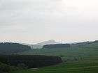 | |
| Gieschberg | 652.0 | North Eifel | Euskirchen | Site of the village of Giescheid on the summit | |
| Nerother Kopf | 651.7 | Volcanic Eifel | Vulkaneifel | Type: cinder cone; site of the ruined castle of Freudenkoppe |
|
| Prümer Kopf | 645.6 | Schnee Eifel | Eifelkreis Bitburg-Prüm | |
|
| Bockshahn | 643.7 | High Eifel | Ahrweiler | |
|
| Rote Heck | 639.9 | High Eifel | Vulkaneifel | |
|
| Kamberg | 637.8 | North Eifel, Zitterwald |
Euskirchen | |
|
| Eselsberg | 637 | Vulkan Eifel | Vulkaneifel | |
|
| Hahnheister | 636.3 | High Fens | Aachen (GE), Liège (B) |
|
|
| Auf dem Gericht | 632.8 | West Eifel | Vulkaneifel | |
|
| Apert | 631.3 | South Eifel | Eifelkreis Bitburg-Prüm | |
|
| Hohe Warte | 628.2 | North Eifel | Ahrweiler | |
|
| Aremberg | 623.8 | Ahr Hills | Ahrweiler | Highest elevation of the Ahr Hills; site of Burg Aremberg |
 |
| Dietzenley | 617.6 | Volcanic Eifel | Vulkaneifel | Highest mountain of the Pelmer Forest, site of wooden observation post | |
| Auf der Kopp | 615.5 | South Eifel | Eifelkreis Bitburg-Prüm | |
|
| Höchstberg | 616 | Vulkan Eifel | Vulkaneifel | |
|
| Auf der Wurst | 615.0 | North Eifel | Ahrweiler | |
|
| Dreiser Höhe | 610.8 | High Eifel | Vulkaneifel | |
|
| Hohe Mark | 609 | High Fens | Liège (B) | |
|
| Huscheid | 607.9 | West Eifel | Eifelkreis Bitburg-Prüm | |
|
| Steffelnkopf | 607 | Schnee Eifel | Vulkaneifel | |
|
| Hardtkopf | 601.5 | South Eifel | Eifelkreis Bitburg-Prüm | Highest hill on the edge of the Prümer Kalkmulde | |
| Achelter | 595.7 | Schnee Eifel | Vulkaneifel / Eifelkreis Bitburg-Prüm |
|
|
| Heidenköpfe see: – Heidenkopf I: – Heidenkopf II: – Heidenkopf III: D |
595 [2] 591 588,5 595 |
Ripsdorf Forest, North Eifel | Euskirchen / Vulkaneifel |
|
|
| Rödelkaul | 592.3 | Volcanic Eifel | Vulkaneifel | |
|
| Arensberg | 561.3 | Vulkan Eifel | Vulkaneifel | |
|
| Daxelberg | 588.7 | Vulkan Eifel | Vulkaneifel | |
|
| Alter Voß | 589.9 | Volcanic Eifel | Vulkaneifel | |
|
| Bradscheid | 588.2 | Volcanic Eifel | Vulkaneifel | |
|
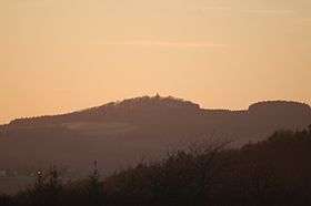
| Michelsberg | 586.1 | Ahr Hills | Euskirchen | Highest elevation in Bad Münstereifel; site of St. Michael's Chapel |
 |
| Hochsimmer | 587.9 | High Eifel | Mayen-Koblenz | Site of the Hochsimmer Tower, an observation tower |  |
| unnamed summit Langschoß |
583.67 | Hohes Venn, Hürtgen Forest |
Aachen, Düren |
Site of the old NATO direction-finding station, an observation tower and a telecommunication tower; Nearby: fire lookout tower |
|
| Perlerkopf | 579.1 | North Eifel | Ahrweiler | |
|
| Gänsehals | 575.3 | High Eifel | Mayen-Koblenz | |
|
| Denskopf | 577.0 | High Eifel | Mayen-Koblenz | |
|
| Lichtenborner Höhe | 570.6 | South Eifel | Eifelkreis Bitburg-Prüm | |
|
| Kalvarienberg | 569 | Schneifel | Eifelkreis Bitburg-Prüm | |
|
| Engelner Kopf | 569 | North Eifel | Ahrweiler | |
|
| Dackscheidberg | 568 | South Eifel | Eifelkreis Bitburg-Prüm | |
|
| Losenseifen | 568 | South Eifel | Eifelkreis Bitburg-Prüm | |
|
| Eigart | 565 | North Eifel | Euskirchen | Eifel National Park | |
| Hochstein | 562.5 | High Eifel | Mayen-Koblenz | Site of Genoveva Cave | 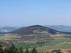 |
| Auf dem Thron | 562 | North Eifel | Ahrweiler | |
|
| Mäuseberg | 561 | Vulkan Eifel | Vulkaneifel | Site of Dronke Tower |  |
| Kneiff | 560 | ??? Eifel | Diekirch District, Luxembourg | Highest point in Luxembourg | 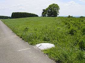 |
| Buurgplaatz | 559 | ??? Eifel | Diekirch District, Luxembourg | Second highest point in Luxembourg; often erroneously thought to be the highest | 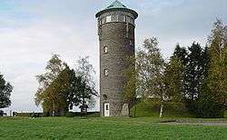 |
| Steineberger Ley | 558 | Vulkan Eifel | Vulkaneifel | Site of Vulcano Infoplattform (observation tower) |  |
| Junkerberg | 557 | Ahr Hills | Ahrweiler | |
|
| Rockeskyller Kopf | 555 | Vulkan Eifel | Vulkaneifel | Type: volcano | |
| Winterberg (Vulkaneifel) |
555 | Vulkan Eifel | Vulkaneifel | |
|
| Daxberg | 549 | South Eifel | Vulkaneifel | |
|
| Hoher List | 549 | Vulkan Eifel | Vulkaneifel | Site of Hoher List Observatory |  |
| Alter Burgberg | 548 | High Eifel | Ahrweiler, Vulkaneifel |
|
|
| Auf Holbert | 543 | South Eifel | Eifelkreis Bitburg-Prüm | |
|
| Ahrberg | 540 | High Eifel | Vulkaneifel | |
|
| Hahn | 539 | Schnee-Eifel | Vulkaneifel | |
|
| Hirzberg | 538 | Ripsdorfer Wald | Euskirchen | |
|
| Knippberg | 537 | Ahr Hills | Euskirchen | |
|
| Muxerather Höhe | 535 | South Eifel | Eifelkreis Bitburg-Prüm | |
|
| Hühnerberg | 533.5 | Ahr Hills | Euskirchen | |
|
| Hohe Kuppe | 531 | South Eifel | Eifelkreis Bitburg-Prüm | |
|
| Steinerberg | 531 | North Eifel | Ahrweiler | |
 |
| Kuppe near Wolfgarten | 527.8 | Rur Eifel, Kermeter |
Euskirchen | Highest elevation in the Kermeter; Eifel National Park; site of Wolfgarten Fire Tower |
|
| Scheidkopf | 527 | Osteifel | Mayen-Koblenz | |
|
| Hellberg | 525.8 | Rur Eifel, Kermeter |
Euskirchen | Eifel National Park | |
| Wildbretshügel | 525.3 | Rur Eifel, Kermeter |
Euskirchen | Eifel National Park | |
| Goldberg | 523 | South Eifel | Vulkaneifel | |
|
| Kalvarienberg | 523 | North Eifel | Euskirchen | |
|
| Kirchberg | 520 | North Eifel | Euskirchen | |
|
| Lenzerath | 519.3 | Schnee-Eifel | Vulkaneifel | |
|
| Mosenberg | 519 | Vulkan Eifel | Bernkastel-Wittlich | Site of Windsborn crater lake, summit cross and observation post |
 |
| Verbrannter Berg | 515.5 | Rur Eifel, Kermeter |
Euskirchen | Eifel National Park | |
| Kopnück | 514 | Ahr Hills | Euskirchen | |
|
| Wendelsberg | 513 | Vulkan Eifel | Vulkaneifel | site of Daun Deer Park (aka: Stag and Boar Park) |
|
| Geerberg | 510 | Vulkan Eifel | Cochem-Zell, Mayen-Koblenz |
|
|
| Vulkan Kalem | 509,4 | South Eifel | Vulkaneifel | |
|
| Häuschen | 507 | North Eifel | Ahrweiler | Ruins of an observation tower | |
| Hahnenkopf | 505 | South Eifel | Eifelkreis Bitburg-Prüm | |
|
| Winterberg (Kermeter) |
503.4 | Rur Eifel, Kermeter |
|
Site of Kermeterstollen below the western flanks of the hill | |
| Hochthürmen | 499.8 | North Eifel | Ahrweiler, Euskirchen |
Site of Roman circular fort |  |
| Pflugberg | 498 | North Eifel | Euskirchen | |
|
| Teufelsley | 496 | North Eifel | Ahrweiler | |
|
| Hardtberg | 495 | South Eifel | Eifelkreis Bitburg-Prüm | |
|
| Honigberg | 495 | Rur Eifel, Kermeter |
Düren | Eifel National Park; viewing point for the Rur Reservoir | |
| Adert | 488 | North Eifel | Ahrweiler | Popular viewing point | |
| Hasenberg | 471 | North Eifel | Ahrweiler | |
|
| Römerberg | 470 | Vulkan Eifel | Vulkaneifel | |
|
| Krufter Ofen | 463 | Vulkan Eifel | Mayen-Koblenz | |
|
| Weidenauer Berg | 453.3 | Rur Eifel, Kermeter |
Düren | Eifel National Park | |
| Laacher Kopf | 442 | Vulkan Eifel | Ahrweiler | Nearby: Maria Laach Abbey and Laacher See |
|
| Kellerberg | 448 | Meulenwald | Bernkastel-Wittlich | Highest elevation of the Meulenwald; site of Kellerberg observation tower |
|
| Stockert | 435 | Münstereifel Forest | Euskirchen | Site of Astropeiler Stockert radio-telescope | |
| Herkelstein | 434.5 | North Eifel | Euskirchen | |
|
| Veitskopf | 428 | Vulkan Eifel | Ahrweiler | Type: volcano; Nearby: Laacher See; site of Observation tower Lydia Tower |
|
| Ettringer Bellerberg (also: Ettringer Bellberg) |
427.5 | High Eifel | Mayen-Koblenz | Site of crater landscape | |
| Hummerich (also: Plaidter Hummerich) |
425 | Vulkan Eifel | Mayen-Koblenz | Type: volcano; Nearby: Laacher See |
|
| Monzeler Hüttenkopf | 421 | Moselle Hills | Bernkastel-Wittlich | |
|
| Mehringer Berg | 418 | Moselle Hills | Trier-Saarburg | |
|
| Falkenlay | 414 | Pre-Eifel | Cochem-Zell | Observation post below the summit | |
| Hansenberg | 401 | Moselle Hills | Bernkastel-Wittlich | |
|
| Zoonenberg | 401 | Meulenwald | Trier-Saarburg | |
|
| Burgberg | 400.5 | Rur Eifel, North Eifel |
Düren | Site of former Berenstein imperial castle and Krawutschke observation tower | 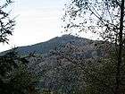 |
| Thelenberg | 400 | Vulkan Eifel | Mayen-Koblenz / Ahrweiler | |
|
| Arenberg | 399 | Pre-Eifel | Cochem-Zell | |
|
| Sollig | 398 | Pre-Eifel | Cochem-Zell | |
|
| Hühnerberg | 398 | Ahr Hills | Ahrweiler | Nearby: Effelsberg Radio Telescope | |
| Sonnenberg | 393,3 | Rur Eifel, North Eifel |
Düren | |
|
| Eickelslay | 390 | Moselle Eifel | |
|
|
| Blumkirst | 389 | Pre-Eifel | Cochem-Zell | |
|
| Hornberg | 388 | North Eifel | Ahrweiler | |
|
| Calmont | 378 | Pre-Eifel | Cochem-Zell | Has the steepest individual vineyard in Europe | |
| Hochkopf | 376 | North Eifel | Rhein-Sieg-Kreis | |
 |
| Thomasberg | 378 | Moselle Hills | Bernkastel-Wittlich | |
|
| Steckenberg | 366 | North Eifel | Ahrweiler | Site of observation tower |  |
| Rothenberg | 365 | Moselle Hills | Bernkastel-Wittlich | |
|
| Mayener Bellerberg („Mayener Bellberg“) | 363 | High Eifel | Mayen-Koblenz | |
|
| Krausberg | 360 | North Eifel | Ahrweiler | Site of Krausberg Tower and Krausberghütte |
 |
| Römerberg | 359 | Meulenwald | Trier-Saarburg | |
|
| Bausenberg | 340 | North Eifel | Ahrweiler | Type: volcano | |
| Neuenahrer Berg | 339 | North Eifel | Ahrweiler | Site of ruined castle of Neuenahr and Langer Köbes observation tower | 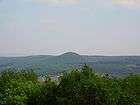 |
| Tomberg | 316 | North Eifel | Rhein-Sieg-Kreis | Type: volcano; Tomburg castle |  |
| Hochburg | 306 | South Eifel | Trier-Saarburg | Old Celtic refuge castle: Hochburg | |
| Elterlay | 294 | South Eifel | Trier-Saarburg | Genoveva Cave | |
| Beuelskopf | 291.9 | North Eifel | Rhein-Sieg-Kreis | Remains of the Hans-Wischeler Tower | |
| Scheidskopf | 280 | North Eifel | Ahrweiler | Site of partly accessible quarry and Roman ringwork | |
| Landskrone | 272 | North Eifel | Ahrweiler | Site of Landskron Castle | 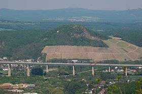 |
References and footnotes
- ↑ There is no universally agreed definition of a mountain, but Whittow (1984) suggests 2,000 feet or ~600 metres as common
- ↑ Topographic Information Management, Cologne - NRW GEObasis Division (info)
Sources
- Whittow, John (1984). Dictionary of Physical Geography. London: Penguin, 1984. ISBN 0-14-051094-X.
This article is issued from Wikipedia - version of the 10/29/2016. The text is available under the Creative Commons Attribution/Share Alike but additional terms may apply for the media files.