List of islands of Ponce, Puerto Rico
This list of islands in Ponce, Puerto Rico, is a summary of the seven islands that form part of the municipality of Ponce, Puerto Rico. It consists of islands, keys, and cays, and similarly named geographic features surrounded by large bodies of water, namely, the Caribbean Sea.[1][2]
Island list summary table
| No. | Name | Area | Location | Type | Comment |
|---|---|---|---|---|---|
| 1 | Isla de Cardona | 0.04 km2 (9.9 acres) | Playa, Ponce | Island | Also known as Isla Sor Isolina Ferré |
| 2 | Isla de Ratones | 0.03 km2 (7.4 acres) | Canas, Ponce | Island | Not to be confused with Isla de Ratones in Cabo Rojo |
| 3 | Isla del Frío | 0.01 km2 (2.5 acres) | Vayas, Ponce | Island | Administered by the Puerto Rico Department of Natural and Environmental Resources |
| 4 | Caja de Muertos | 1.54 km2 (380 acres) | Playa, Ponce | Island | Largest of the islands |
| 5 | Isla Morrillito | 0.04 km2 (9.9 acres) | Playa, Ponce | Island | A protected nature reserve; Connected to Caja de Muertos by a bank of shallow waters about 5.49 meters deep |
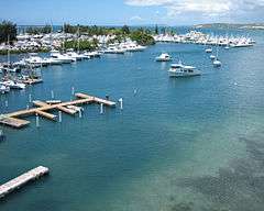
| 6 | Isla de Gatas | 0.05 km2 (12 acres) | Playa, Ponce | Island | Has been artificially joined to the Ponce mainland and is now occupied by Club Nautico de Ponce |
| 7 | Isla de Jueyes | 0.01 km2 (2.5 acres) | Vayas, Ponce | Island | Actually a group of three small islands |
Gallery
-
.jpg)
Isla de Cardona as seen from Club Náutico de Ponce
-
%2C_Ponce%2C_PR_(DSC05629).jpg)
Isla Ratones as seen from Hotel Ponce Holiday Inn
-
.jpg)
Isla del Frio as seen from the shores of Juana Diaz
-
.jpg)
Caja de Muertos approaching from the Northwest
-
.jpg)
Isla Morrillito as seen from the Caja de Muertos Light
-

Isla de Gatas, now home to Club Náutico de Ponce
-
.jpg)
Isla de Jueyes as seen from the Observation Tower at La Guancha
References
- ↑ Maptest. Government of the Commonwealth of Puerto Rico. General Purpose Population Data, Census 2000. Unidad de Sistemas de Información Geográfica, Área de Tecnología de Información Gubernamental, Oficina de Gerencia y Presupuesto. Gobierno de Puerto Rico. Accessed 7 June 2016.
- ↑ Webcensus. Government of the Commonwealth of Puerto Rico. General Purpose Population Data, Census 2000. Unidad de Sistemas de Información Geográfica, Área de Tecnología de Información Gubernamental, Oficina de Gerencia y Presupuesto. Gobierno de Puerto Rico. Accessed 7 June 2016.
This article is issued from Wikipedia - version of the 6/8/2016. The text is available under the Creative Commons Attribution/Share Alike but additional terms may apply for the media files.