List of cities in Nevada

Nevada is a state located in the Western United States. According to the 2010 United States Census, Nevada is the 36th most populous state with 2,700,691 inhabitants but the 7th largest by land area spanning 109,781.18 square miles (284,332.0 km2) of land.[1] Nevada is divided into 17 counties and contains 19 incorporated municipalities.[2] Incorporated places in the state are legally described as cities, except for Carson City, which has no legal description.[2] Nevada's incorporated municipalities cover only 1% of the state's land mass but are home to 56.7% of its population.[1]
The largest municipality by population in Nevada is Las Vegas with 583,756 residents, and the smallest municipality by population is Caliente with 1,130 residents.[1] The largest municipality by land area is Boulder City which spans 208.52 sq mi (540.1 km2), while Lovelock is the smallest at 0.85 sq mi (2.2 km2).[1]
Incorporated cities and towns
- Largest cities and towns in Nevada by population
-
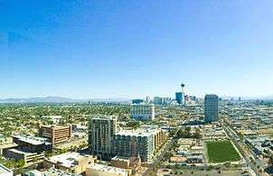
Downtown Las Vegas, Nevada's largest city
-
.jpg)
Arial view of Henderson, Nevada, suburb of Las Vegas Nevada's second largest city
-
Skyline of Reno, third largest city in Nevada
-
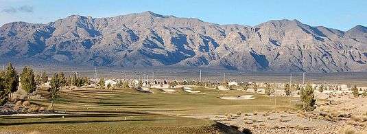
Mountains around North Las Vegas, suburb of Las Vegas
-
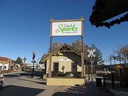
Sparks, Nevada's fifth largest city
-

Carson City, Nevada's capital and sixth largest city
-
_in_Fernley%2C_Nevada.jpg)
Main street of Nevada's newest city, Fernley
-

Downtown Elko, eight largest city in Nevada
-
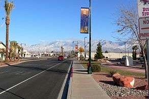
Downtown Mesquite, Nevada's ninth largest city
-
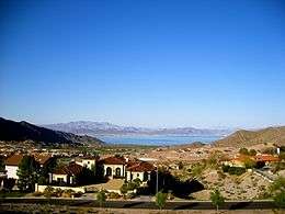
View of Boulder City, Nevada's tenth largest city, and Lake Mead
State capital and Independent city ![]()
| Name | Type[1] | County[1] | Population (2010)[1] |
Population (2000)[1] |
Change (%) | Land area (2010)[1] |
Density | |
|---|---|---|---|---|---|---|---|---|
| sq mi | km2 | |||||||
| Boulder City | City | Clark | 15,023 | 14,966 | +0.4% | 208.52 | 540.1 | 72.0/sq mi (27.8/km2) |
| Caliente | City | Lincoln | 1,130 | 1,123 | +0.6% | 1.87 | 4.8 | 604.3/sq mi (233.3/km2) |
| Carlin | City | Elko | 2,368 | 2,161 | +9.6% | 10.44 | 27.0 | 226.8/sq mi (87.6/km2) |
| Carson City | City | None | 55,274 | 52,457 | +5.4% | 144.66 | 374.7 | 382.1/sq mi (147.5/km2) |
| Elko | City | Elko | 18,297 | 16,708 | +9.5% | 17.64 | 45.7 | 1,037.2/sq mi (400.5/km2) |
| Ely | City | White Pine | 4,255 | 4,041 | +5.3% | 7.64 | 19.8 | 556.9/sq mi (215.0/km2) |
| Fallon | City | Churchill | 8,606 | 7,536 | +14.2% | 3.63 | 9.4 | 2,370.8/sq mi (915.4/km2) |
| Fernley[lower-alpha 1] | City | Lyon | 19,368 | NA | 122.12 | 316.3 | 158.6/sq mi (61.2/km2) | |
| Henderson | City | Clark | 257,729 | 175,381 | +47.0% | 107.73 | 279.0 | 2,392.4/sq mi (923.7/km2) |
| Las Vegas | City | Clark | 583,756 | 478,434 | +22.0% | 135.81 | 351.7 | 4,298.3/sq mi (1,659.6/km2) |
| Lovelock | City | Pershing | 1,894 | 2,003 | −5.4% | 0.85 | 2.2 | 2,228.2/sq mi (860.3/km2) |
| Mesquite | City | Clark | 15,276 | 9,389 | +62.7% | 31.89 | 82.6 | 479.0/sq mi (185.0/km2) |
| North Las Vegas | City | Clark | 216,961 | 115,488 | +87.9% | 101.35 | 262.5 | 2,140.7/sq mi (826.5/km2) |
| Reno | City | Washoe | 225,221 | 180,480 | +24.8% | 103.01 | 266.8 | 2,186.4/sq mi (844.2/km2) |
| Sparks | City | Washoe | 90,264 | 66,346 | +36.1% | 35.76 | 92.6 | 2,524.2/sq mi (974.6/km2) |
| Wells | City | Elko | 1,292 | 1,346 | −4.0% | 6.90 | 17.9 | 187.2/sq mi (72.3/km2) |
| West Wendover | City | Elko | 4,410 | 4,721 | −6.6% | 7.48 | 19.4 | 589.6/sq mi (227.6/km2) |
| Winnemucca | City | Humboldt | 7,396 | 7,174 | +3.1% | 9.39 | 24.3 | 787.6/sq mi (304.1/km2) |
| Yerington | City | Lyon | 3,048 | 2,883 | +5.7% | 8.60 | 22.3 | 354.4/sq mi (136.8/km2) |
| Total | — | — | 1,531,568 | 1,142,637 | +34.0% | 1,065.29 | 2,759.1 | 1,437.7/sq mi (555.1/km2) |
Notes
References
- 1 2 3 4 5 6 7 8 9 "GCT-PH1 – Population, Housing Units, Area, and Density: 2010 – State — Place and (in selected states) County Subdivision". 2010 United States Census. United States Census Bureau. Retrieved September 16, 2016.
- 1 2 "Nevada: 2010 Population and Housing Unit Counts 2010 Census of Population and Housing" (PDF). 2010 United States Census. United States Census Bureau. September 2012. p. III-2. Retrieved August 8, 2016.
- ↑ "2000-2010 Entity Changes" (txt). 2010 United States Census. United States Census Bureau. Retrieved June 17, 2016.
See also
List of census-designated places in Nevada