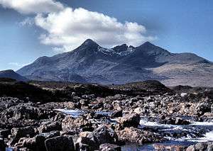
List of Scottish counties by highest point
This is a list of the 33 Counties of Scotland by their highest point.
| Rank | County | Height (m) | Height (ft)1 | Name | Grid reference |
|---|
| 1 | Inverness-shire | 1,344 | 4,409 | Ben Nevis | NN166712 |
| 2= | Aberdeenshire | 1,309 | 4,295 | Ben Macdhui | NN988989 |
| 2= | Banffshire | 1,309 | 4,295 | Ben Macdhui | NN988989 |
| 4 | Perthshire | 1,214 | 3,983 | Ben Lawers | NN635414 |
| 5 | Ross and Cromarty | 1,183 | 3,881 | Carn Eige | NH123261 |
| 6 | Argyll | 1,150 | 3,773 | Bidean nam Bian | NN143542 |
| 7 | Angus | 1,068 | 3,504 | Glas Maol | NO166765 |
| 8 | Sutherland | 998 | 3,274 | Ben More Assynt | NC318201 |
| 9 | Stirlingshire | 974 | 3,196 | Ben Lomond | NN367028 |
| 10 | Dunbartonshire | 943 | 3,094 | Ben Vorlich | NN295124 |
| 11 | Bute | 874 | 2,867 | Goatfell | NR991415 |
| 12 | Kirkcudbrightshire | 843 | 2,766 | Merrick | NX427855 |
| 13= | Peeblesshire | 840 | 2,756 | Broad Law | NT146235 |
| 13= | Selkirkshire | 840 | 2,756 | Broad Law | NT146235 |
| 15 | Dumfriesshire | 821 | 2,694 | White Coomb | NT163151 |
| 16 | Ayrshire | 782 | 2,565 | Kirriereoch Hill shoulder | NX421870 |
| 17 | Kincardineshire | 778 | 2,552 | Mount Battock | NO549844 |
| 18 | Lanarkshire | 748 | 2,454 | Culter Fell | NT052290 |
| 19 | Roxburghshire | 743 | 2,438 | Cairn Hill West Top (Hangingstone Hill) | NT895193 |
| 20 | Clackmannanshire | 721 | 2,365 | Ben Cleuch | NN902006 |
| 21 | Moray | 710 | 2,329 | Carn a' Ghille Chearr | NJ139298 |
| 22 | Caithness | 706 | 2,316 | Morven | ND004285 |
| 23 | Nairnshire | 659 | 2,162 | Carn Glas-choire | NH891291 |
| 24 | Midlothian | 651 | 2,136 | Blackhope Scar | NT315483 |
| 25 | East Lothian | 535 | 1,755 | Meikle Says Law | NT581617 |
| 26 | Berwickshire | 532 | 1,746 | Meikle Says Law shoulder | NT581616 |
| 27= | Fife | 522 | 1,713 | West Lomond | NO197066 |
| 27= | Renfrewshire | 522 | 1,713 | Hill of Stake | NS273630 |
| 29 | Kinross-shire | 497 | 1,631 | Innerdouny Hill | NO032073 |
| 30 | Orkney | 481 | 1,578 | Ward Hill | HY228022 |
| 31 | Shetland | 450 | 1,476 | Ronas Hill | HU305834 |
| 32 | Wigtownshire | 322 | 1,056 | Craigairie Fell | NX236736 |
| 33 | West Lothian | 312 | 1,024 | Cairnpapple Hill (South Top) | NS987711 |
|
Footnotes
- The foot measurement is derived from the Ordnance Survey metre measurement, multiplied by 3.2808.
- Although it ceased to exist as a county in 1890, Cromartyshire was a distinct county consisting chiefly of the Black Isle, with the county town of Cromarty, and the district of Ullapool, with a number of enclaves scattered in the body of Ross-shire, in between.The highest point of the County of Cromarty is Sgurr Mor in the Fannichs at os grid reference NH200694. It is 3642 ft (or 1110 m) high - making it 7th in the list, and creating 34 traditional counties of Scotland.
See also
References
Mountains and hills of Great Britain and Ireland |
|---|
|
|
|
| Scotland | | |
|---|
|
| England | |
|---|
|
| Wales | |
|---|
|
| Northern Ireland | |
|---|
|
| Republic of Ireland | |
|---|
|
|
