| [3] |
Name on the Register[4] |
Image |
Date listed[5] |
Location |
City or town |
Description |
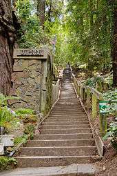
|---|
| 1 |
Alexander-Acacia Bridge |
|
000000001984-01-05-0000January 5, 1984
(#84000903) |
Alexander Avenue between Acacia and Monte Vista Avenues
37°55′48″N 122°31′55″W / 37.929978°N 122.532033°W / 37.929978; -122.532033 (Alexander-Acacia Bridge) |
Larkspur |
|
| 2 |
Angel Island, U.S. Immigration Station |
|
000000001971-10-14-0000October 14, 1971
(#71000164) |
Southeast of Tiburon in San Francisco Bay
37°51′44″N 122°25′53″W / 37.862222°N 122.431389°W / 37.862222; -122.431389 (Angel Island, U.S. Immigration Station) |
Tiburon |
|
| 3 |
William G. Barrett House |
|
000000001980-06-17-0000June 17, 1980
(#80004490) |
156 Bulkley Avenue
37°51′25″N 122°28′52″W / 37.856936°N 122.481225°W / 37.856936; -122.481225 (William G. Barrett House) |
Sausalito |
|
| 4 |
Boyd House |
|
000000001974-12-17-0000December 17, 1974
(#74000528) |
1125 B Street
37°58′31″N 122°31′46″W / 37.975281°N 122.529369°W / 37.975281; -122.529369 (Boyd House) |
San Rafael |
Now houses the Marin History Museum
|
| 5 |
Bradford House |
|
000000001980-06-06-0000June 6, 1980
(#80000818) |
333 G Street
37°58′37″N 122°32′13″W / 37.976931°N 122.536817°W / 37.976931; -122.536817 (Bradford House) |
San Rafael |
|
| 6 |
China Camp |
|
000000001979-04-26-0000April 26, 1979
(#79000493) |
247 North San Pedro Drive
38°00′03″N 122°27′41″W / 38.000844°N 122.461339°W / 38.000844; -122.461339 (China Camp) |
San Rafael |
|
| 7 |
The Dipsea Trail |
|
000000002010-06-04-0000June 4, 2010
(#10000356) |
Throckmorton Avenue, Sequoia Valley Road, Panoramic Highway, State Route 1, Muir Woods National Monument, Golden Gate National Recreation Area
Coordinates missing |
Mill Valley and Stinson Beach |
|
| 8 |
Dixie Schoolhouse |
|
000000001972-12-26-0000December 26, 1972
(#72000236) |
2255 Las Gallinas Avenue
38°01′46″N 122°32′46″W / 38.029347°N 122.546192°W / 38.029347; -122.546192 (Dixie Schoolhouse) |
San Rafael |
|
| 9 |
Robert Dollar Estate |
|
000000001972-12-11-0000December 11, 1972
(#72000237) |
1408 Mission Avenue
37°58′33″N 122°31′56″W / 37.975822°N 122.532108°W / 37.975822; -122.532108 (Robert Dollar Estate) |
San Rafael |
|
| 10 |
Robert Dollar House |
|
000000001991-07-23-0000July 23, 1991
(#91000920) |
115 J Street
37°58′48″N 122°32′28″W / 37.979872°N 122.541122°W / 37.979872; -122.541122 (Robert Dollar House) |
San Rafael |
|
| 11 |
Dolliver House |
|
000000001978-05-22-0000May 22, 1978
(#78000703) |
58 Madrone Avenue
37°55′53″N 122°32′15″W / 37.931386°N 122.537525°W / 37.931386; -122.537525 (Dolliver House) |
Larkspur |
|
| 12 |
Drakes Bay Historic and Archeological District |
|
000000002012-10-16-0000October 16, 2012
(#12001006) |
Address Restricted
38°02′03″N 122°56′27″W / 38.034223°N 122.940800°W / 38.034223; -122.940800 (Drakes Bay Historic and Archeological District) |
Point Reyes Station |
The recognized landing site of Francis Drake in 1579 and Sebastian Rodriguez Cermeño in 1595, and the early interactions between Native Americans and these European visitors.
|
| 13 |
Fashion Shop and Stephen Porcella House |
|
000000001980-06-25-0000June 25, 1980
(#80000817) |
800 Grant Avenue and 1009 Reichert Avenue
38°06′26″N 122°33′59″W / 38.107253°N 122.5665°W / 38.107253; -122.5665 (Fashion Shop and Stephen Porcella House) |
Novato |
|
| 14 |
Forts Baker, Barry, and Cronkhite |
|
000000001973-12-12-0000December 12, 1973
(#73000255) |
South of Sausalito off U.S. Route 101
37°50′09″N 122°28′40″W / 37.835833°N 122.477778°W / 37.835833; -122.477778 (Forts Baker, Barry, and Cronkhite) |
Sausalito |
Forts Baker, Barry and Cronkhite form a historical district together.
|
| 15 |
Green Brae Brick Yard |
|
000000001978-03-24-0000March 24, 1978
(#78000704) |
125 East Sir Francis Drake Boulevard
37°56′41″N 122°30′20″W / 37.944822°N 122.505517°W / 37.944822; -122.505517 (Green Brae Brick Yard) |
Larkspur |
Now known as The Melting Pot restaurant
|
| 16 |
Griswold House |
|
000000001985-09-12-0000September 12, 1985
(#85002306) |
639 Main Street
37°50′56″N 122°29′07″W / 37.848764°N 122.485172°W / 37.848764; -122.485172 (Griswold House) |
Sausalito |
|
| 17 |
Hamilton Army Air Field Discontiguous Historic District |
|
000000001998-11-20-0000November 20, 1998
(#98001347) |
Mostly the southwest part of Hamilton Army Air Field
38°03′33″N 122°30′52″W / 38.059147°N 122.514444°W / 38.059147; -122.514444 (Hamilton Army Air Field Discontiguous Historic District) |
Novato |
|
| 18 |
Larkspur Downtown Historic District |
|
000000001982-10-07-0000October 7, 1982
(#82000972) |
234-552½ Magnolia Avenue
37°56′06″N 122°32′08″W / 37.935136°N 122.535461°W / 37.935136; -122.535461 (Larkspur Downtown Historic District) |
Larkspur |
|
| 19 |
Lyford's Stone Tower |
|
000000001976-12-02-0000December 2, 1976
(#76000497) |
2034 Paradise Drive
37°52′24″N 122°26′57″W / 37.873392°N 122.449253°W / 37.873392; -122.449253 (Lyford's Stone Tower) |
Tiburon |
|
| 20 |
Benjamin and Hilarita Lyford House |
|
000000002000-11-10-0000November 10, 2000
(#00001268) |
376 Greenwood Beach Road
37°53′40″N 122°29′50″W / 37.894464°N 122.497297°W / 37.894464; -122.497297 (Benjamin and Hilarita Lyford House) |
Tiburon |
|
| 21 |
Marin County Civic Center |
|
000000001991-07-17-0000July 17, 1991
(#91002055) |
Junction of North San Pedro Road and Civic Center Drive
37°59′51″N 122°31′49″W / 37.997514°N 122.530353°W / 37.997514; -122.530353 (Marin County Civic Center) |
San Rafael |
The last commission of architect Frank Lloyd Wright[6]
|
| 22 |
Erskine B. McNear House |
|
000000001982-01-11-0000January 11, 1982
(#82002204) |
121 Knight Drive
37°59′06″N 122°28′46″W / 37.985131°N 122.479419°W / 37.985131; -122.479419 (Erskine B. McNear House) |
San Rafael |
|
| 23 |
Miller Creek School Indian Mound |
Upload image |
000000001971-10-14-0000October 14, 1971
(#71000163) |
Address restricted
|
San Rafael |
|
| 24 |
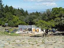
Mount Tamalpais Mountain Theater |
|
000000002015-02-02-0000February 2, 2015
(#14001234) |
3801 Panoramic Hwy.
37°54′47″N 122°36′30″W / 37.913°N 122.6084°W / 37.913; -122.6084 (Mount Tamalpais Mountain Theater) |
Mill Valley |
|
| 25 |
Muir Beach Archeological Site |
Upload image |
000000001981-01-26-0000January 26, 1981
(#81000097) |
Address restricted
|
Marin City |
|
| 26 |
Muir Woods National Monument |
|
000000002008-01-09-0000January 9, 2008
(#07001396) |
Muir Woods Road
37°53′33″N 122°34′20″W / 37.892547°N 122.572286°W / 37.892547; -122.572286 (Muir Woods National Monument) |
Mill Valley |
|
| 27 |
Olema Lime Kilns |
|
000000001976-10-08-0000October 8, 1976
(#76000217) |
4 mi (6.4 km) southeast of Olema on State Route 1
37°59′18″N 122°44′46″W / 37.988333°N 122.746111°W / 37.988333; -122.746111 (Olema Lime Kilns) |
Olema |
|
| 28 |
Outdoor Art Club |
|
000000001978-11-16-0000November 16, 1978
(#78000705) |
1 W. Blithedale Avenue
37°54′25″N 122°32′49″W / 37.906897°N 122.546883°W / 37.906897; -122.546883 (Outdoor Art Club) |
Mill Valley |
1904 American Craftsman style clubhouse designed by Bernard Maybeck. 1923 wing by William Huson. With mature gardens and pergola.[7]
|
| 29 |
Pierce Ranch |
|
000000001985-12-06-0000December 6, 1985
(#85003324) |
Point Reyes National Seashore
38°11′23″N 122°57′15″W / 38.1896°N 122.954244°W / 38.1896; -122.954244 (Pierce Ranch) |
Inverness |
|
| 30 |
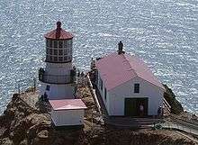
Point Bonita Light Station |
|
000000001991-09-03-0000September 3, 1991
(#91001099) |
Point Bonita
37°48′56″N 122°31′46″W / 37.815608°N 122.529542°W / 37.815608; -122.529542 (Point Bonita Light Station) |
Sausalito |
Built in 1887 in the Marin Headlands at entrance to San Francisco Bay. Last manned lighthouse on the California coast (until 1980).
|
| 31 |
Point Reyes Lifeboat Rescue Station, 1927 |
|
000000001985-11-07-0000November 7, 1985
(#85002756) |
Drake's Bay, Point Reyes National Seashore
37°59′39″N 122°58′25″W / 37.994122°N 122.973747°W / 37.994122; -122.973747 (Point Reyes Lifeboat Rescue Station, 1927) |
Inverness |
|
| 32 |
Point Reyes Light Station |
|
000000001991-09-03-0000September 3, 1991
(#91001100) |
Point Reyes National Seashore
37°59′44″N 123°01′24″W / 37.995511°N 123.023217°W / 37.995511; -123.023217 (Point Reyes Light Station) |
Point Reyes |
Completed and first lit in 1870. Automated in 1975.
|
| 33 |
Rancho Olompali |
|
000000001973-01-12-0000January 12, 1973
(#73000409) |
Olompali State Historic Park
38°09′12″N 122°34′18″W / 38.153333°N 122.571667°W / 38.153333; -122.571667 (Rancho Olompali) |
Novato |
Site of Coast Miwok village, Mexican Rancho Olompali and subsequent ranch buildings.
|
| 34 |
Valentine Rey House |
|
000000001982-04-22-0000April 22, 1982
(#82002203) |
428 Golden Gate Avenue
37°51′54″N 122°27′37″W / 37.865067°N 122.460306°W / 37.865067; -122.460306 (Valentine Rey House) |
Belvedere |
|
| 35 |
San Francisco and North Pacific Railroad Station House-Depot |
|
000000001995-08-04-0000August 4, 1995
(#95000997) |
1920 Paradise Drive
37°52′21″N 122°27′08″W / 37.872589°N 122.452186°W / 37.872589; -122.452186 (San Francisco and North Pacific Railroad Station House-Depot) |
Tiburon |
|
| 36 |
San Rafael Improvement Club |
|
000000001984-03-29-0000March 29, 1984
(#84000907) |
1800 5th Avenue
37°58′30″N 122°32′20″W / 37.975094°N 122.538756°W / 37.975094; -122.538756 (San Rafael Improvement Club) |
San Rafael |
|
| 37 |
Sausalito Woman's Club |
|
000000001993-04-15-0000April 15, 1993
(#93000272) |
120 Central Avenue
37°51′07″N 122°28′51″W / 37.851886°N 122.48095°W / 37.851886; -122.48095 (Sausalito Woman's Club) |
Sausalito |
1918 building by Bay Area architect Julia Morgan[8]
|
| 38 |
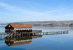
Brock Schreiber Boathouse and Beach |
|
000000001978-07-07-0000July 7, 1978
(#78000702) |
12830 Sir Francis Drake Boulevard
38°06′01″N 122°51′16″W / 38.100314°N 122.854436°W / 38.100314; -122.854436 (Brock Schreiber Boathouse and Beach) |
Inverness |
|
| 39 |
Station KPH Operating Station |
|
000000001989-07-24-0000July 24, 1989
(#89000819) |
18500 State Route 1
38°08′39″N 122°52′38″W / 38.144167°N 122.877222°W / 38.144167; -122.877222 (Station KPH Operating Station) |
Marshall |
|
| 40 |
Station KPH, Marconi Wireless Telegraph Company of America |
|
000000001989-07-24-0000July 24, 1989
(#88003223) |
18500 State Route 1
38°08′39″N 122°52′38″W / 38.144167°N 122.877222°W / 38.144167; -122.877222 (Station KPH, Marconi Wireless Telegraph Company of America) |
Marshall |
|
| 41 |
Steamship TENNESSEE Remains |
Upload image |
000000001981-04-15-0000April 15, 1981
(#81000102) |
Address Restricted
|
Marin City |
|
| 42 |
Tomales Presbyterian Church and Cemetery |
|
000000001975-08-01-0000August 1, 1975
(#75000437) |
11 Church Street
38°14′43″N 122°54′26″W / 38.245325°N 122.907111°W / 38.245325; -122.907111 (Tomales Presbyterian Church and Cemetery) |
Tomales |
|
| 43 |
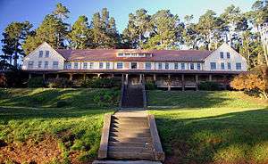
West Point Inn |
|
000000002011-12-22-0000December 22, 2011
(#11000934) |
Old railroad grade, Mt. Tamalpais
37°55′00″N 122°35′38″W / 37.916686°N 122.593903°W / 37.916686; -122.593903 (West Point Inn) |
Mill Valley |
1904 inn at the westernmost point of the Mount Tamalpais and Muir Woods Railway[9] |


.jpg)


