Lille Kufjorden
| Lille Kufjorden Unna Vuođđovuonaš | |
|---|---|
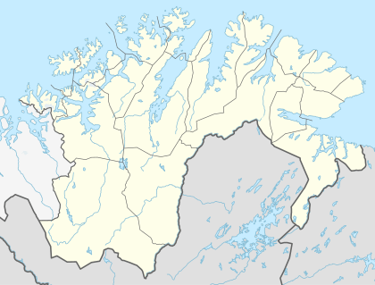
 Lille Kufjorden Location in Finnmark | |
| Location | Alta Municipality, Finnmark |
| Coordinates | 70°21′11″N 22°58′13″E / 70.3530°N 22.9704°ECoordinates: 70°21′11″N 22°58′13″E / 70.3530°N 22.9704°E |
| Basin countries | Norway |
| Max. length | 2 kilometres (1.2 mi) |
| Max. depth | 81 metres (266 ft) |
Lille Kufjorden (Northern Sami: Unna Vuođđovuonaš) is a fjord on the south side of the island of Seiland in Alta Municipality, Finnmark county, Norway. The fjord is about 2 kilometres (1.2 mi) long, emptying into the Rognsundet strait on the south end of the fjord.[1]
The mouth of the fjord is between Junkerhamnklubben to the west and Klubben to the east. Junkerhamn is a tiny farm the same size as the Junkerhamnklubben peninsula. Otherwise than that one farm, there are no settlements around the fjord. The fjord is 81 metres (266 ft) at its deepest point (at the mouth of the fjord, near Klubben). The fjord sits a few kilometres south of Seiland National Park.
See also
References
- ↑ "Lille Kufjorden" (in Norwegian). yr.no. Retrieved 2013-01-16.
This article is issued from Wikipedia - version of the 5/21/2013. The text is available under the Creative Commons Attribution/Share Alike but additional terms may apply for the media files.