Lemwerder
| Lemwerder | ||
|---|---|---|
|
Chapel at the dyke | ||
| ||
 Lemwerder | ||
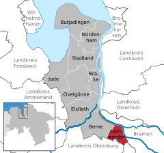
Location of Lemwerder within Wesermarsch district 
 | ||
| Coordinates: 53°10′N 8°37′E / 53.167°N 8.617°ECoordinates: 53°10′N 8°37′E / 53.167°N 8.617°E | ||
| Country | Germany | |
| State | Lower Saxony | |
| District | Wesermarsch | |
| Government | ||
| • Mayor | Hans-Joachim Beckmann (SPD) | |
| Area | ||
| • Total | 36.38 km2 (14.05 sq mi) | |
| Population (2015-12-31)[1] | ||
| • Total | 6,940 | |
| • Density | 190/km2 (490/sq mi) | |
| Time zone | CET/CEST (UTC+1/+2) | |
| Postal codes | 27809 | |
| Dialling codes | 0421 | |
| Vehicle registration | BRA | |
| Website | www.lemwerder.de | |
Lemwerder is a municipality in the district of Wesermarsch, in Lower Saxony, Germany. It is situated on the left bank of the Weser, approx. 27 km east of Oldenburg, and 17 km northwest of the centre of Bremen.
Since September 2001 it is governed by the mayor Hans-Joachim Beckmann.
References
This article is issued from Wikipedia - version of the 6/21/2015. The text is available under the Creative Commons Attribution/Share Alike but additional terms may apply for the media files.

