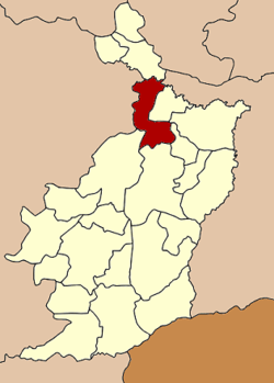
Khu Mueang District
| Khu Mueang คูเมือง | |
|---|---|
| Amphoe | |
 Amphoe location in Buriram Province | |
| Coordinates: 15°16′18″N 103°0′6″E / 15.27167°N 103.00167°ECoordinates: 15°16′18″N 103°0′6″E / 15.27167°N 103.00167°E | |
| Country | Thailand |
| Province | Buriram |
| Seat | Khu Mueang |
| Area | |
| • Total | 442.0 km2 (170.7 sq mi) |
| Population (2005) | |
| • Total | 66,839 |
| • Density | 151.2/km2 (392/sq mi) |
| Time zone | ICT (UTC+7) |
| Postal code | 31190 |
| Geocode | 3102 |
Khu Mueang (Thai: คูเมือง, pronounced [kʰūː mɯ̄a̯ŋ]) is a district (amphoe) in the northern part of Buriram Province, northeastern Thailand.
Geography
Neighboring districts are (from the east clockwise) Khaen Dong, Satuek, Ban Dan, Mueang Buriram, Lam Plai Mat of Buriram Province, Lam Thamenchai, Mueang Yang of Nakhon Ratchasima Province, Phutthaisong of Buriram Province again and Chumphon Buri of Surin Province.
History
The minor district (king amphoe) was created on 1 October 1969, when the three tambon Khu Mueang, Tum Yai, and Pa Khiap containing 58 villages were split off from Mueang Buriram District.[1] It was upgraded to a full district on 21 August 1975.[2]
Administration
The district is divided into seven sub-districts (tambon), which are further subdivided into 113 villages (muban). There are two townships (thesaban tambon): Khu Meang covers parts of tambon Khu Mueang and Nong Khaman; Hin Lek Fai covers parts of tambon Hin Lek Fai and also parts of Khu Mueang. There are a further seven tambon administrative organizations (TAO).
| No. | Name | Thai name | Villages | Pop. | |
|---|---|---|---|---|---|
| 1. | Khu Mueang | คูเมือง | 14 | 9,319 | |
| 2. | Pakhiap | ปะเคียบ | 17 | 10,801 | |
| 3. | Ban Phae | บ้านแพ | 11 | 7,264 | |
| 4. | Phon Samran | พรสำราญ | 19 | 9,567 | |
| 5. | Hin Lek Fai | หินเหล็กไฟ | 24 | 10,508 | |
| 6. | Tum Yai | ตูมใหญ่ | 18 | 11,971 | |
| 7. | Nong Khaman | หนองขมาร | 10 | 7,409 |
References
- ↑ ประกาศกระทรวงมหาดไทย เรื่อง แบ่งท้องที่ตั้งเป็นกิ่งอำเภอ (PDF). Royal Gazette (in Thai). 86 (99 ง special): 3329. November 11, 1969.
- ↑ พระราชกฤษฎีกาตั้งอำเภอแวงน้อย อำเภอป่าแดด อำเภอเรณูนคร อำเภอคูเมือง อำเภอคุระบุรี อำเภอแม่ลาน้อย อำเภอเสริมงาม อำเภอไพรบึง และอำเภอหนองโดน พ.ศ. ๒๕๑๘ (PDF). Royal Gazette (in Thai). 92 (166 ก special issue): 1–4. August 21, 1975.