Kheri Jasaur
| Jasaur kheri जसौर खेडी | |
|---|---|
| Village | |
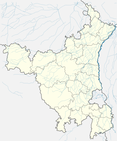
 Jasaur kheri  Jasaur kheri Location in Haryana, India | |
| Coordinates: 28°47′N 76°52′E / 28.78°N 76.86°ECoordinates: 28°47′N 76°52′E / 28.78°N 76.86°E | |
| Country |
|
| State | Haryana |
| District | Jhajjar |
| Languages | |
| • Official | Haryanvi, Hindi, English |
| Time zone | IST (UTC+5:30) |
| PIN | 124505 |
| Telephone code | 01276 |
| Vidhan Sabha constituency | Bahadurgarh |
| Civic agency | Village Panchayat |
Jasaur Kheri is a twin village [Jasaur + Kheri] in Jhajjar District of Indian state of Haryana. It is located on Bahadurgarh-Sonepat road; it is about 16 km from nearest city Bahadurgarh. The village is famous for its ancient Mata Chandraghanta (Chorasi Ghanto wali) Devi temple. Every year villagers organise a big 'Jagrata' on the eve of Ashtami in Navaratras, followed by Bhandara in morning. On side of temple there is Harshringi lake, Whose water is considered very holy and used for bathing gods and goddesses in temple.Harshringi name of devi mandir is named after HARSHRINGI(HAR means shri krishan and SHRINGI is the name of a famous saint). There is a Hospital and water treatment plant established by Government of Harayna to cater health needs of people. Village also has its own stadium and akhara, where boys work on their physique and improve wrestling skills. Most of the people living here, work in government departments located in Delhi. It is 40 km from National Capital New Delhi and can be reached by both train or road.
Atomic Research Centre
Government of India is establishing an Atomic Research Centre in the village in about 400 acres of land. This is the 6th Research and Development unit under the aegis of Department of atomic Energy. In future this centre will get direct connectivity to New Delhi Airport and will play pivotal role in Atomic Energy Research and Development.[1]
KMP Expressway
Kundli-Manesar-Palwal 8 lane under construction Expressway passes through the village.
Banks in Jasaur Kheri
- Oriental Bank of Commerce
- Sarv Haryana Gramin Bank
- Poor People Helping Group:Not Registered
Member Strength: 150
Connectivity
Nearest Railway Station is Asauda (6 km). Limited State Transport is available for Bahadurgarh and Sonepat.