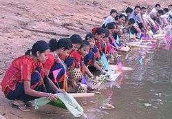
Khagrachhari District
| Khagrachhari খাগড়াছড়ি | |
|---|---|
| District | |
| Nickname(s): প্রাকৃতিক সৌন্দর্যের রাণী (The Queen of Natural Beauty) | |
 Location of Khagrachhari in Bangladesh | |
| Coordinates: BD 23°02′30″N 91°59′40″E / 23.0417°N 91.9944°ECoordinates: BD 23°02′30″N 91°59′40″E / 23.0417°N 91.9944°E | |
| Country |
|
| Division | Chittagong Division |
| Area | |
| • Total | 2,749.16 km2 (1,061.46 sq mi) |
| Population (2011 census) | |
| • Total | 613,917 |
| • Density | 220/km2 (580/sq mi) |
| Time zone | BST (UTC+6) |
| Postal code | 4400 |

Khagrachhari (Bengali: খাগড়াছড়িBengali pronunciation: [khagrat͡ɕʰori/khagrat͡sʰori]) is a district in south-eastern Bangladesh. It is a part of the Chittagong Division[1] and the Chittagong Hill Tracts.[2] Its local name is "Chengmi". Khagrachhari is also known as Phalang Htaung (ဖလံေထာင္) or the Mong Circle (of the rest of the three hill districts Rangamati is the Chakma Circle (သက္ေထာင္) and Bandarban (ဗိုလ္မင္းေထာင္) is the Bohmong Circle). Khagrachhari town is the home town of the Mong Chief (currently King, or Raja, Saching Prue Chowdhury ဗိုလ္မင္း သာစိန္ျဖဴ) who is the head of the Arakanese descendants living in the circle. It also is the administrative headquarters of Khagrachhari district. Khagrachhari Local Govt. Council was established on 6 March 1989 to uphold the political, social, cultural, educational and economic right and to expedite the process of socio-economic development of all residents of Khagrachhari Hill District. According to Peace Accord this council was renamed as “Khagrachari Hill District Council (KHDC)” by the Act-10 of 1998. Now this council has been regarded as the main focal point of administration as well as development activities of the district.[3]
Geography
Khagrachhari is a valley. It has three river namely Chengi, Kasalong and Maini. Chengi is the longest river in Khagrachhari. Most of the areas of Khagrachhari are hilly areas. The main ethnic groups living in the district are Tripuras, Chakmas, Bengalis and Marmas.
Subdivisions
Upazilas under this district are:
- Dighinala Upazila
- Khagrachhari Upazila
- Lakshmichhari Upazila
- Mahalchhari Upazila
- Manikchhari Upazila
- Matiranga Upazila
- Panchhari Upazila
- Ramgarh Upazila
- Guimara Upazila
Administration
Deputy Commissioner (DC): Muhammad Wahiduzzaman
Chairman of Hill District Council: Mr. Kongjari Chowdhury
Mong king: Chai Hla Prue Chowdhury
Economy
Most of the people lives on Jhum cultivation.There are also people of various profession like Teacher, Farmer, Businessmen etc.
NGO in Khagrachhari:UNDP, Parbatya Bouddha Mission (PBM), established in 1983,a non profit organization, is working for the socio-economic, educational and cultural development of the poor people in the Khagrachhari Hill District of the Chittagong Hill Tracts (CHT) of Bangladesh.[4]
Education
Khagrachhari Govt. College, established in 1975. The college is now situated on 8.5 acres of land in a beautiful natural environment near the entrance gate of Khagrachhari town beside the main road of the hilly district.[5] Khagrachhri Cantonmet public school and college was established in 2006.Despite being a new institution it has become a renowned one for the students of Khagrachhari. Khagrachhari govt girls high school established in 1985. It is a renowned school for girls in Khagrachhari. It has high qualified teaching staff. The school is now situated on 4 acres of land in beautiful natural environment.
Religious composition (1991)
Muslim - 34.45%, Buddhist - 48.51%, Hindu - 16.69%, Christian - 0.27% and Others - 0.08. Religious institutions 2472 mosques, 937 Buddhist (656 pagodas, 281 temples), 170 temples and 4 churches.[6]
Member of ninth Parliament
Khagrachhari Seat 298: Jatindra Laal Tripura [from Awami League][7][8] Before Jatindra Laal Tripura, Wadud Bhuiyan was the Member of Parliament of Khagrachhari Seat 298. He was also the Chairman of the Chittagong Hill Tracts Development Board at that period. Wadud Bhuiyan was two times MP.
See also
References
| Wikimedia Commons has media related to Khagrachhari District. |
- ↑ Tripura, Barendro Lal (2012). "Khagrachhari District". In Islam, Sirajul; Jamal, Ahmed A. Banglapedia: National Encyclopedia of Bangladesh (Second ed.). Asiatic Society of Bangladesh.
- ↑ Chowdhury, Sifatul Quader (2012). "Chittagong Hill Tracts". In Islam, Sirajul; Jamal, Ahmed A. Banglapedia: National Encyclopedia of Bangladesh (Second ed.). Asiatic Society of Bangladesh.
- ↑ “Khagrachari Hill District Council,” last modified 2013, http://www.khdcbd.org/home/programs.
- ↑ http://www.pbm-cht.org/
- ↑ http://www.bdeducationonline.com/khagrachariclg/index.php?option=com_content&view=article&id=1:khagrachari-govt-college&catid=1:latest-news
- ↑ Amar Desh
- ↑ http://www.parliament.gov.bd/mp_list_9th.htm
- ↑ http://www.lcgbangladesh.org/parliament/allmps.php
