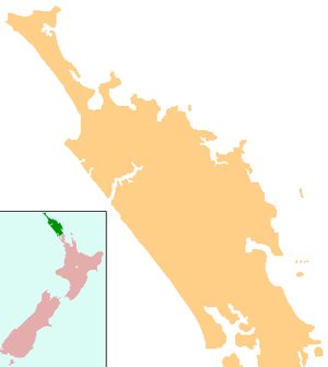
Karetu
| Karetu | |
|---|---|
 Karetu | |
| Coordinates: 35°22′14″S 174°9′5″E / 35.37056°S 174.15139°ECoordinates: 35°22′14″S 174°9′5″E / 35.37056°S 174.15139°E | |
| Country | New Zealand |
| Region | Northland Region |
| District | Far North District |
Karetu is a locality in the Northland Region of the North Island of New Zealand. Kawakawa is to the west, and Waikare is northeast. The Karetu River flows from the Russell Forest in the southeast through Karetu, and joins the Kawakawa River shortly before it flows into the Bay of Islands.[1][2]
The name is a Māori word for Hierochloe redolens, a sweet-scented grass used in sachets and to make girdles.[3]
Education
Karetu School is a decile 3 coeducational primary school serving years 1-8. It has a roll of 52.;[4] the school was established in 1886.[5]
References
- ↑ Peter Dowling (editor) (2004). Reed New Zealand Atlas. Reed Books. pp. map 5. ISBN 0-7900-0952-8.
- ↑ Roger Smith, GeographX (2005). The Geographic Atlas of New Zealand. Robbie Burton. pp. maps 21, 24. ISBN 1-877333-20-4.
- ↑ A W Reed (2002). The Reed Dictionary of New Zealand Place Names. p. 241. ISBN 0-7900-0761-4.
- ↑ Te Kete Ipurangi schools database: Karetu school
- ↑ "Karetu School".
This article is issued from Wikipedia - version of the 8/30/2015. The text is available under the Creative Commons Attribution/Share Alike but additional terms may apply for the media files.