Kangarilla, South Australia
| Kangarilla South Australia | |||||||||||||
|---|---|---|---|---|---|---|---|---|---|---|---|---|---|
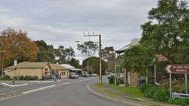
 Main street of Kangarilla | |||||||||||||
 Kangarilla | |||||||||||||
| Coordinates | 35°08′53″S 138°39′36″E / 35.148°S 138.660°ECoordinates: 35°08′53″S 138°39′36″E / 35.148°S 138.660°E | ||||||||||||
| Population | 928 (2006 census)[1] | ||||||||||||
| Postcode(s) | 5157 | ||||||||||||
| Elevation | 195 m (640 ft) | ||||||||||||
| Location | 41 km (25 mi) from Adelaide | ||||||||||||
| LGA(s) | City of Onkaparinga | ||||||||||||
| Federal Division(s) | Division of Mayo | ||||||||||||
| |||||||||||||
Kangarilla is a town near Adelaide, South Australia. It lies within the City of Onkaparinga and has postcode 5157. At the 2006 census, Kangarilla had a population of 928.[1]
History
The land around Kangarilla was first settled in around 1840, with wheat and vineyards the main produce. A town was founded in 1849 by John Bottrill, and properly surveyed in 1860.[2] The name was changed regularly in the early days; originally called Scaldwell, then Eyre Flat, the name "Kangarilla" (a word from the local Kaurna language meaning "place of two springs") was settled upon in 1862.[2]
See also
Notes and references
- 1 2 Australian Bureau of Statistics (25 October 2007). "Kangarilla (State Suburb)". 2006 Census QuickStats. Retrieved 9 August 2011.
- 1 2 http://www.southaustralianhistory.com.au/kangarilla.htm
This article is issued from Wikipedia - version of the 8/5/2016. The text is available under the Creative Commons Attribution/Share Alike but additional terms may apply for the media files.