Jakta
| Jakta | |
|---|---|
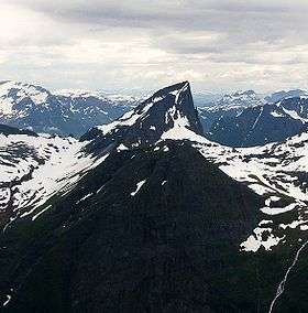 Jakta seen from Slogen | |
| Highest point | |
| Elevation | 1,588 m (5,210 ft) |
| Prominence | 539 m (1,768 ft) |
| Coordinates | 62°10′15″N 06°37′00″E / 62.17083°N 6.61667°ECoordinates: 62°10′15″N 06°37′00″E / 62.17083°N 6.61667°E |
| Geography | |
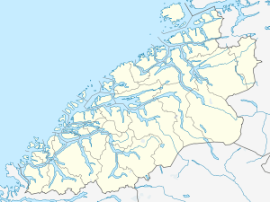 Jakta Location in Møre og Romsdal | |
| Location | Ørsta, Møre og Romsdal, Norway |
| Parent range | Sunnmørsalpene |
| Topo map | 1219 III Hjørundfjord |
| Climbing | |
| First ascent | 1896: H.C. Bowen and C.W. Patchell |
Jakta is a 1,588-metre (5,210 ft) tall mountain in the Sunnmørsalpene mountain range. It is located in the municipality of Ørsta in Møre og Romsdal county, Norway. Jakta lies 5 kilometres (3.1 mi) south of the nearby mountain Slogen and just across the Hjørundfjorden from the mountain Skårasalen. The village of Leira lies 5 kilometres (3.1 mi) south of Jakta.[1]
References
- ↑ "Jakta, 1589m". WestCoastPeaks.com. Retrieved 2010-09-21.
External links
This article is issued from Wikipedia - version of the 5/28/2015. The text is available under the Creative Commons Attribution/Share Alike but additional terms may apply for the media files.