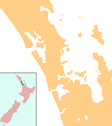
Hunua Falls
| Hunua Falls | |
|---|---|
 | |
 | |
| Location | Hunua |
| Coordinates | 37°04′07″S 175°05′23″E / 37.06861°S 175.08972°ECoordinates: 37°04′07″S 175°05′23″E / 37.06861°S 175.08972°E |
| Elevation | 60 metres (200 ft) |
| Total height | 30 metres (98 ft) |
The Hunua Falls are on the Wairoa River in the Auckland Region of New Zealand, near Hunua. The land around was bought by Auckland for water supplies between 1940 and 1960.[1] The mean flow of water downstream at Clevedon is 2.6 m3 (570 imp gal)/s,[2] but can vary greatly, as illustrated in photographs showing the falls in winter and summer.
Natural features
The Wairoa River falls over a basalt lava plug. Volcanic tuff rings and lava bombs are visible in the east wall of the waterfall.[3]
Several herbs have been identified near the falls - water starwort (Callitriche petriei), Crassula hunua, water pennywort (Hydrocotyle microphylla) , wood-sorrel (Oxalis magellanica).[4]
The Wairoa has smaller falls. Lily Falls (also known as Wairoa Falls)[5] were described as 70 ft (21 m) high[6] and 3 mi (4.8 km) downstream from Hunua, in the Wairoa Gorge.[7] A photograph appeared in 1901.
Access and recreational activities
As well as tracks to the Hunua Ranges, there are two 30 minute walks; The Lookout Walk and the Upper Lookout Walk. The cliffs are used for abseiling.[8]
References
- ↑ ARC Regional Parks - Hunua Falls history
- ↑ Land Air Water Aeotearoa - Wairoa
- ↑ Auckland Unitary Plan Appendix 3.1: Schedule of Outstanding Natural Features 2013
- ↑ NZ Plant Conservation Network - Waterfall Floras of the North
- ↑ New Zealand waterfalls website
- ↑ New Zealand Herald, 17 March 1888 THE HUNUA AND ITS ATTRACTIONS
- ↑ Auckland Star, 2 February 1928 - Hunua's Cataract
- ↑ NZ Encyclopaedia - waterfalls