Houston, Mississippi
| Houston, Mississippi | |
|---|---|
| City | |
 | |
 Location of Houston, Mississippi | |
 Houston, Mississippi Location in the United States | |
| Coordinates: 33°53′53″N 89°0′6″W / 33.89806°N 89.00167°WCoordinates: 33°53′53″N 89°0′6″W / 33.89806°N 89.00167°W | |
| Country | United States |
| State | Mississippi |
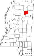
| County | Chickasaw |
| Area | |
| • Total | 7.39 sq mi (19.15 km2) |
| • Land | 7.38 sq mi (19.11 km2) |
| • Water | 0.02 sq mi (0.05 km2) |
| Elevation | 354 ft (108 m) |
| Population (2010)[1] | |
| • Total | 3,623 |
| • Density | 491/sq mi (189.6/km2) |
| Time zone | Central (CST) (UTC-6) |
| • Summer (DST) | CDT (UTC-5) |
| ZIP code | 38851 |
| Area code(s) | 662 |
| FIPS code | 28-33900 |
| GNIS feature ID | 0693543 |
| Website | Houston, Mississippi |
Houston is a city in and one of two county seats of Chickasaw County, in northern Mississippi.[2] The population was 3,623 at the 2010 census. Judge Joel Pinson donated land for development of a town on the condition that it would be named for Sam Houston, a childhood friend.
In 1909, Houston became home to the first Carnegie library in the state after L.B. Reid, the superintendent of schools at this time, wrote to Andrew Carnegie, an industrialist and philanthropist who created a matching program for libraries, telling of the need for a public library.
Houston hosts the Mississippi Flywheel Festival in April and September of every year.
Geography
Houston is located west of the center of Chickasaw County at 33°53′53″N 89°0′6″W / 33.89806°N 89.00167°W (33.898090, -89.001646).[3] Mississippi Highway 8 passes through the city, leading east 29 miles (47 km) to Aberdeen and west 18 miles (29 km) to Calhoun City. Mississippi Highway 15 bypasses the city to the west, crossing Highway 8 within a western extension of the city limits. Highway 15 leads north 26 miles (42 km) to Pontotoc and south 27 miles (43 km) to Mathiston. The Natchez Trace Parkway passes about 3 miles (5 km) east of the city center; the Trace followed an ancient Native American trail.
According to the United States Census Bureau, the city has a total area of 7.39 square miles (19.15 km2), of which 7.38 square miles (19.11 km2) is land and 0.02 square miles (0.05 km2), or 0.25%, is water.[4]
Demographics
| Historical population | |||
|---|---|---|---|
| Census | Pop. | %± | |
| 1870 | 400 | — | |
| 1880 | 480 | 20.0% | |
| 1890 | 893 | 86.0% | |
| 1900 | 677 | −24.2% | |
| 1910 | 1,400 | 106.8% | |
| 1920 | 1,408 | 0.6% | |
| 1930 | 1,477 | 4.9% | |
| 1940 | 1,729 | 17.1% | |
| 1950 | 1,664 | −3.8% | |
| 1960 | 2,577 | 54.9% | |
| 1970 | 2,720 | 5.5% | |
| 1980 | 3,745 | 37.7% | |
| 1990 | 3,903 | 4.2% | |
| 2000 | 4,079 | 4.5% | |
| 2010 | 3,623 | −11.2% | |
| Est. 2015 | 3,544 | [5] | −2.2% |
As of the census[7] of 2000, there were 4,079 people, 1,589 households, and 1,088 families residing in the city. The population density was 537.4 people per square mile (207.5/km²). There were 1,721 housing units at an average density of 226.8 per square mile (87.5/km²). The racial makeup of the city was 59.89% White, 36.58% African American, 0.27% Native American, 0.17% Asian, 0.12% Pacific Islander, 2.70% from other races, and 0.27% from two or more races. Hispanic or Latino of any race were 5.12% of the population.
There were 1,589 households out of which 33.5% had children under the age of 18 living with them, 44.6% were married couples living together, 19.4% had a female householder with no husband present, and 31.5% were non-families. 29.1% of all households were made up of individuals and 15.0% had someone living alone who was 65 years of age or older. The average household size was 2.49 and the average family size was 3.06.
In the city the population was spread out with 26.6% under the age of 18, 10.3% from 18 to 24, 26.9% from 25 to 44, 19.5% from 45 to 64, and 16.8% who were 65 years of age or older. The median age was 35 years. For every 100 females there were 88.3 males. For every 100 females age 18 and over, there were 83.6 males.
The median income for a household in the city was $23,709, and the median income for a family was $31,979. Males had a median income of $27,214 versus $22,000 for females. The per capita income for the city was $12,482. About 22.6% of families and 21.2% of the population were below the poverty line, including 17.8% of those under age 18 and 28.0% of those age 65 or over.
Transportation
Houston was once served by both the Gulf, Mobile and Ohio Railroad and Okolona, Houston & Calhoun City Railway. In the early 21st century, both of these rail lines were abandoned. Sections of the former have been converted to a recreational trail.
Education
The city of Houston is served by the Houston School District. Houston High School is the community's high school.
Houston Public Schools system is home to 11-time National Dell-Winston Solar Car Challenge Championships.
Climate
The climate in this area is characterized by hot, humid summers and generally mild to cool winters. According to the Köppen Climate Classification system, Houston has a humid subtropical climate, abbreviated "Cfa" on climate maps.[8]
References
- ↑ "2010 City Population and Housing Occupancy Status". U.S. Census Bureau. Retrieved May 14, 2012.
- ↑ "Find a County". National Association of Counties. Retrieved 2011-06-07.
- ↑ "US Gazetteer files: 2010, 2000, and 1990". United States Census Bureau. 2011-02-12. Retrieved 2011-04-23.
- ↑ "Geographic Identifiers: 2010 Demographic Profile Data (G001): Houston city, Mississippi". U.S. Census Bureau, American Factfinder. Retrieved October 3, 2014.
- ↑ "Annual Estimates of the Resident Population for Incorporated Places: April 1, 2010 to July 1, 2015". Retrieved July 2, 2016.
- ↑ "Census of Population and Housing". Census.gov. Retrieved June 4, 2015.
- ↑ "American FactFinder". United States Census Bureau. Retrieved 2008-01-31.
- ↑ Climate Summary for Houston, Mississippi
