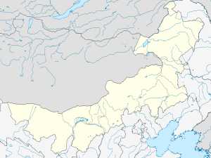
Honggor Sumu, Siziwang Banner
| Honggor Sumu 红格尔苏木 | |
|---|---|
| Ethnic sumu | |
 Honggor Sumu Location in Inner Mongolia | |
| Coordinates: 42°02′30″N 111°32′14″E / 42.04167°N 111.53722°ECoordinates: 42°02′30″N 111°32′14″E / 42.04167°N 111.53722°E | |
| Country | China |
| Region | Inner Mongolia |
| Prefecture-level city | Ulanqab |
| Banner | Siziwang Banner |
| Elevation | 1,267 m (4,157 ft) |
| Population (2000) | |
| • Total | 2,594 |
| Time zone | China Standard (UTC+8) |
| Postal code | 150929 |
| Area code(s) | 0474 |
Honggor Sumu (Mongolian: "soft" or "sweetheart"; simplified Chinese: 红格尔苏木; traditional Chinese: 紅格爾蘇木; pinyin: Hónggé'ěr Sūmù) is a sumu in the Siziwang Banner of Ulanqab, Inner Mongolia, China. In 2000, it had 2594 inhabitants.[1] It is about 134 kilometres (83 mi) north-northwest of Hohhot, the capital of Inner Mongolia.
References
- ↑ www.xzqh.org: 四子王旗—内蒙古自治区—中国—行政区划网 (in Chinese)
This article is issued from Wikipedia - version of the 2/10/2016. The text is available under the Creative Commons Attribution/Share Alike but additional terms may apply for the media files.