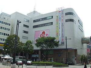
Hon-Atsugi Station
Hon-Atsugi Station 本厚木駅 | |
|---|---|
 North Exit of Hon-Atsugi Station | |
| Location |
1 Izumicho, Atsugi, Kanagawa (神奈川県厚木市泉町1丁目) Japan |
| Operated by | Odakyu Electric Railway |
| Line(s) | Odakyu Odawara Line |
| Connections |
|
| History | |
| Opened | 1927 |
| Previous names | Sagami-Atsugi (until 1944) |
| Traffic | |
| Passengers (FY2008) | 146,668 daily |

Hon-Atsugi Station (本厚木駅 Hon-Atsugi-eki) is a major railway station on the Odakyu Odawara Line in Atsugi, Kanagawa, Japan, operated by the private railway operator Odakyu Electric Railway.
Lines
The station is 45.5 kilometers from the line's terminal at Shinjuku Station. Most local, section semi-express, and semi-express trains inbound from Shinjuku Station terminate at this stop and head back to Shinjuku. West of this station, most express trains stop at every station until the line terminus in Odawara Station. All rapid express and most limited express (Romancecar) services also stop here.
Station layout
Hon-Atsugi Station is an elevated structure built into the building used by the Mylord shopping mall (one of four such shopping malls owned by the Odakyu Group). One of the station's exits leads directly into the 4th level of the shopping mall.[1] The station has two island platforms serving four tracks.
Platforms
| 1 | ■ Odakyu Odawara Line | for Shin-Matsuda, Odawara, (Hakone-Tozan Railway) Hakone-Yumoto |
| 2 | ■ Odakyu Odawara Line | for Shin-Matsuda, Odawara, (Hakone-Tozan Railway) Hakone-Yumoto, (Asagiri) Gotemba |
| 3 | ■ Odakyu Odawara Line | for Machida, Shinjuku, (Chiyoda Line) |
| 4 | ■ Odakyu Odawara Line | for Machida, Shinjuku, (Chiyoda Line) |
Adjacent stations
| ← | Service | → | ||
|---|---|---|---|---|
| Odakyu Odawara Line | ||||
| Atsugi | Local | Aikō-Ishida | ||
| Atsugi | Semi-Express | Aikō-Ishida | ||
| Ebina | Express | Aikō-Ishida | ||
| Ebina | Rapid Express | Aikō-Ishida | ||
| Machida Sagami-Ōno |
Ltd. Exp. "Romance Car" | Hadano Odawara | ||
History
The station opened on April 1, 1927 as Sagami-Atsugi Station (相模厚木駅) for through trains. At that time, trains stopping at every station ran between Shinjuku station and Inada-Noborito Station (稲田登戸駅), now Mukōgaoka-Yūen) and did not continue to Hon-Atsugi. Later, from October 15, 1927, express trains began stopping at the station. The first trains of the Jinchū Railroad (神中鉄道), present-day Sagami Railway) run from Ebina Station to this station on November 25, 1941 and the station was renamed Hon-Atsugi on June 1, 1944.
After the war, various services were reestablished. The local trains that had been operating between Shinjuku and Inada-Noborito station were run on the whole line, and Hon-Atsugi became a stop for local trains. At the same time, through trains were abolished (June 1945). Consecutively Semi-Express (October 1, 1946), Express (October 1, 1949), Commuting express (March 25, 1955) and Commuting Semi-Express (March 25, 1960) services were introduced. On November 5, 1964 the connection to the Sagami Railway was cut. From 1968 the Romancecar began stops at Hon-Atsugi Station. From June 1976 the station building was rebuilt into an overhead station. Multi-level crossings were successively constructed around the station (March 29, 1977) and from March 31, 1978, the line operated jointly with the Tokyo Metro Chiyoda Line and the JR Jōban Line. Later (March 23, 1982), the Mylord Department Store opened within the station building and the first two automatic ticket machines were installed.
From February 1, 1984 the Asagiri Romancecar service began stopping at Hon-Atsugi and on October 15, 1984, the Atsugi Bus Centre was completed. On December 11, 2004, rapid express and semi-section express services were introduced and began stops in Hon-Atsugi. AEDs were installed in the station on February 23, 2006. In March 2006, waiting rooms were constructed on all platforms.
Surrounding area
- Shoin University Atsugi Station Campus
The station also serves as a transfer point for local and intercity buses operated by Kanagawa Chuo, with direct service to Morioka, Shin-Yokohama Station, Narita Airport, Haneda Airport, Osaka, Kyoto, and Nara.[2]
References
- ↑ Odakyu Electric Railway (Japanese)
- ↑ Kanachu bus company information (Japanese).
External links
| Wikimedia Commons has media related to Hon-Atsugi Station. |
- Hon-Atsugi Station (Odakyū) (Japanese)
Coordinates: 35°26′22″N 139°21′51″E / 35.439338°N 139.364261°E