Black River-Matheson
| Black River-Matheson | |
|---|---|
| Township (single-tier) | |
| Township of Black River-Matheson | |
|
The Vernon L. Miller Memorial Bridge taking Highway 101 across the Black River into Matheson | |
 Black River-Matheson | |
| Coordinates: 48°32′N 80°28′W / 48.533°N 80.467°WCoordinates: 48°32′N 80°28′W / 48.533°N 80.467°W | |
| Country |
|
| Province |
|
| District | Cochrane |
| Government | |
| • Type | Township |
| • Mayor | Garry Edwards |
| • Governing Body | Black River-Matheson Township Council |
| • MP | Charlie Angus (NDP) |
| • MPP | John Vanthof (NDP) |
| Area[1] | |
| • Land | 1,163.41 km2 (449.20 sq mi) |
| Population (2011)[1] | |
| • Total | 2,410 |
| • Density | 2.1/km2 (5/sq mi) |
| Time zone | EST (UTC-5) |
| • Summer (DST) | EDT (UTC-4) |
| Postal code FSA | P0K |
| Area code(s) | 705 |
| Website |
www |
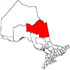
Black River-Matheson is a township in the Cochrane District of the Canadian province of Ontario. The municipality is astride the Black River, for which it is partly named. The Matheson railway station was serviced by the Northlander until 2012.
Mining, forestry and farming are some of the principal industries in the area, augmented by outdoor tourism in the summer, such as fishing and hunting. There are three elementary schools within the municipality.
Communities
The communities in the township are Holtyre, Matheson, Ramore, Shillington, Val-Gagné and Wavell. The main community of Matheson is located at the intersection of highways 11 and 101.
History
Prospecting started in 1909. The Croesus Mine (1914-1918) became "one of the richest mines in Canada," according to Barnes. Gold was like "plums in pudding" and "one gold nugget was egg shaped, two inches long and one and a quarter across." A total of 16 companies operated in the Harker Holloway area from 1917 to 1925, including Harker Gold Mines. P.A. McDermott found a gold-bearing zone in 1922, which became American Barrick's Holt-McDermott Mine in 1988. Located in the Abitibi greenstone belt, the mine produced 60,000 ounces of gold in 1994.[2]
The fire of 1916 left 243 dead.[2]
Demographics
| Canada census – Black River-Matheson community profile | |||
|---|---|---|---|
| 2011 | 2006 | 2001 | |
| Population: | 2410 (-8.0% from 2006) | 2619 (-9.3% from 2001) | 2912 (-9.6% from 1996) |
| Land area: | 1,163.41 km2 (449.20 sq mi) | 1,161.67 km2 (448.52 sq mi) | 2,290.98 km2 (884.55 sq mi) |
| Population density: | 2.1/km2 (5.4/sq mi) | 2.3/km2 (6.0/sq mi) | 1.3/km2 (3.4/sq mi) |
| Median age: | 44.8 (M: 44.2, F: 45.5) | 39.9 (M: 39.3, F: 40.5) | |
| Total private dwellings: | 1172 | 1249 | 1489 |
| Median household income: | $54,794 | $39,743 | |
| References: 2011[1] 2006[3] 2001[4] | |||
- Population in 2011: 2410
- Population in 2006: 2619
- Population in 2001: 2912 (or 2886 when adjusted for 2006 boundaries)
- Population in 1996: 3220
- Population in 1991: 3451
Notable people
- Harry Brightwell, Member of Parliament; born in Matheson.[6]
- Bob McCord, professional hockey player; born in Matheson.[7]
See also
- Matheson Fire
- Bolton Lake
- Canadian Forces Station Ramore
- Wahgoshig First Nation
- Timmins—James Bay Electoral District
- List of townships in Ontario
- List of communities in Ontario
- List of francophone communities in Ontario
- Matachewan, Ontario
- Cobalt silver rush
- Porcupine Gold Rush
- Red Lake, Ontario
- Greenstone, Ontario
- Hemlo, Ontario
References
- 1 2 3 4 "Black River-Matheson census profile". 2011 Census of Population. Statistics Canada. Retrieved 2012-02-21.
- 1 2 Barnes, Michael (1995). Gold in Ontario. Erin: The Boston Mills Press. pp. 95–100. ISBN 155046146X.
- 1 2 "2006 Community Profiles". Canada 2006 Census. Statistics Canada. March 30, 2011. Retrieved 2012-02-21.
- 1 2 "2001 Community Profiles". Canada 2001 Census. Statistics Canada. February 17, 2012. Retrieved 2012-02-21.
- ↑ Statistics Canada 1996 Census - Community Highlights for Black River-Matheson
- ↑ "BRIGHTWELL, A.H. Harry, D.V.M.". Library of Parliament. Retrieved March 2014. Check date values in:
|access-date=(help) - ↑ "Bob Lomer McCord". Hockey Hall of Fame and Museum. Retrieved March 2014. Check date values in:
|access-date=(help)
External links
 |
Iroquois Falls |  | ||
| Timmins | |
Unorganized North Cochrane | ||
| ||||
| | ||||
| Unorganized South West Cochrane | Unorganized West Timiskaming, Unorganized South East Cochrane | Kirkland Lake |
