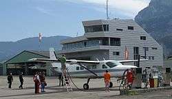
Hohenems-Dornbirn Airport
| Hohenems-Dornbirn Airport Flugplatz Hohenems-Dornbirn | |||||||||||
|---|---|---|---|---|---|---|---|---|---|---|---|
 | |||||||||||
| IATA: HOH – ICAO: LOIH | |||||||||||
| Summary | |||||||||||
| Airport type | Public | ||||||||||
| Serves | Dornbirn, Austria | ||||||||||
| Elevation AMSL | 1,352 ft / 412 m | ||||||||||
| Coordinates | 47°23′4.3″N 009°41′59.2″E / 47.384528°N 9.699778°ECoordinates: 47°23′4.3″N 009°41′59.2″E / 47.384528°N 9.699778°E | ||||||||||
| Map | |||||||||||
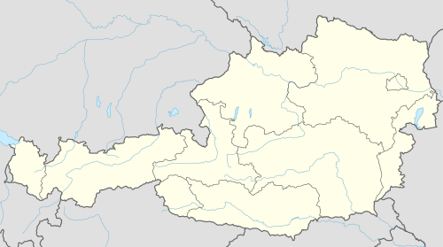 LOIH Location of Hohenems-Dornbirn Airport in Austria | |||||||||||
| Runways | |||||||||||
| |||||||||||
Hohenems-Dornbirn Airport (German: Flugplatz Hohenems-Dornbirn, IATA: HOH, ICAO: LOIH) is a public airport located 5 kilometres (3 mi) southwest of Dornbirn, Vorarlberg, Austria. It is used for general aviation as well as air police and air rescue operations.
See also
References
- ↑ Airport record for Hohenems-Dornbirn Airport at Landings.com. Retrieved 2013-09-01
- ↑ Google (2013-09-01). "location of Hohenems-Dornbirn Airport" (Map). Google Maps. Google. Retrieved 2013-09-01.
External links
![]() Media related to Hohenems Dornbirn Airfield at Wikimedia Commons
Media related to Hohenems Dornbirn Airfield at Wikimedia Commons
This article is issued from Wikipedia - version of the 11/8/2016. The text is available under the Creative Commons Attribution/Share Alike but additional terms may apply for the media files.