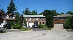
Hillcrest Village
| Hillcrest Village | |
|---|---|
| Neighbourhood | |
 | |
|
| |
| Country |
|
| Province |
|
| City |
|
Hillcrest Village is a neighbourhood located in the district of North York at the northernmost tip of the city of Toronto, Ontario, Canada. Hillcrest Village is considered by some to be part of the Don Valley Village, the neighbourhood directly to the south; however, it is quite distinct. It is bordered by Finch to the South, Leslie Street to the West, Steeles to the North and Victoria Park to the East. Both neighbourhoods share the Don Valley as a point of reference in the Eastern border of the neighbourhoods.
Hillcrest Village is home to one of Toronto's most popular Chinese areas. The top ethnicity in the area is by far Chinese and most recent immigrants to the area continue to arrive from China, Hong Kong and Korea. While there is social housing in the area and a large percentage of residents earning low incomes, many residents earn incomes in the top tax brackets. The 75%+ home ownership rate is another indicator of affluence in the area. However, with considerable little change to the lower income class in one of the census track, many people from the middle income class is gradually moving up to the upper income class.
For comparison reasons, one of the census track within Hillcrest has roughly 64% of immigrant, 34% non-immigrant, and 2% non-permanent resident in the 2011 National Household survey. With a small increase in immigrant from 2006, it is quite unnoticable consider the large amount of residents withint Hillcrest Village.
The Don Valley provides an interesting hillside landscape in the East end of the neighbourhood. In conjunction with Duncan Creek and numerous parks the area has some natural splendour to enjoy.
Public transit in this area is only bus routes. Most of these are operated by the TTC, including the 42 Cummer, 53 Steeles East, 51 Leslie, 25 Don Mills, 39 Finch East, and 24 Victoria Park bus routes. YRT buses run along Don Mills Road en route to York Region, and also serve Seneca College's Newnham Campus.
External links
- Hillcrest Village neighbourhood profile at the City of Toronto website
 |
Markham, Ontario |  | ||
| Bayview Woods-Steeles | |
Steeles | ||
| ||||
| | ||||
| Don Valley Village Pleasant View |
Coordinates: 43°48′00″N 79°21′32″W / 43.800°N 79.359°W