Gouvy
| Gouvy | ||
|---|---|---|
| Municipality | ||
|
Gouvy church | ||
| ||
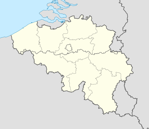 Gouvy Location in Belgium | ||
|
Location of Gouvy in Luxembourg province  | ||
| Coordinates: 50°11′N 05°56′E / 50.183°N 5.933°ECoordinates: 50°11′N 05°56′E / 50.183°N 5.933°E | ||
| Country | Belgium | |
| Community | French Community | |
| Region | Wallonia | |
| Province | Luxembourg | |
| Arrondissement | Bastogne | |
| Government | ||
| • Mayor | André Hubert (GOUVÎT) | |
| • Governing party/ies | IC, GOUVÎT | |
| Area | ||
| • Total | 165.11 km2 (63.75 sq mi) | |
| Population (1 January 2016)[1] | ||
| • Total | 5,156 | |
| • Density | 31/km2 (81/sq mi) | |
| Postal codes | 6670-6674 | |
| Area codes | 080 | |
| Website | www.gouvy.be | |

.svg.png)
Gouvy is a Walloon municipality of Belgium located in the province of Luxembourg.
On 1 January 2007 the municipality, which covers 165.11 km², had 4,780 inhabitants, giving a population density of 29 inhabitants per km².
The municipality was created in 1977 from the amalgamation of the former municipalities of Beho, Bovigny, Cherain, Limerlé, and Montleban. Villages in the municipality include Baclain, Bistain, Brisy, Cherapont, Cierreux, Courtil, Deiffelt, Halconreux, Halonru, Honvelez, Langlire, Lomré, Ourthe, Rettigny, Rogery, Steinbach, Sterpigny, Vaux and Wathermal. The administrative headquarters are situated in Bovigny.
The Ourthe Orientale river originates in the municipality of Gouvy, near the hamlet of Ourthe.
Transportation
It used to have a SNCB station linking it with Bastogne, but passenger train service stopped in 1984. Train traffic is still active on the line between Liège and Luxembourg.
See also
References
- ↑ Population per municipality as of 1 January 2016 (XLS; 397 KB)
External links
-
 Media related to Gouvy at Wikimedia Commons
 - Website of the municipality of Gouvy
- Gouvy: 23 villages (French)
 |
Vielsalm | | ||
| Houffalize | |
Burg-Reuland (WLG) | ||
| ||||
| | ||||
| Wincrange (LU-D) | Troisvierges (LU-D) |
Municipalities of Luxembourg Province | ||
|---|---|---|
| Arlon | 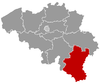 | |
| Bastogne | ||
| Marche-en-Famenne | ||
| Neufchâteau | ||
| Virton | ||