Gakaba Airstrip
| Gakaba Airstrip Gaa Caba | |||||||||||
|---|---|---|---|---|---|---|---|---|---|---|---|
| IATA: none – ICAO: SMGA | |||||||||||
| Summary | |||||||||||
| Airport type | Public | ||||||||||
| Operator | Luchtvaartdienst Suriname | ||||||||||
| Location | Gakaba | ||||||||||
| Elevation AMSL | 192 ft / 59 m | ||||||||||
| Coordinates | 4°27′15″N 54°26′45″W / 4.45417°N 54.44583°WCoordinates: 4°27′15″N 54°26′45″W / 4.45417°N 54.44583°W | ||||||||||
| Map | |||||||||||
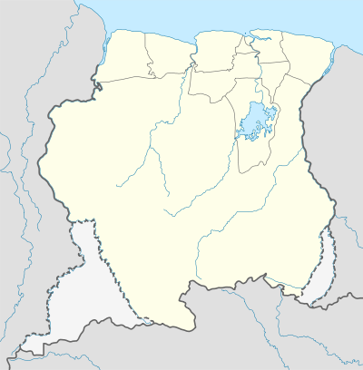 SMGA Location in Suriname | |||||||||||
| Runways | |||||||||||
| |||||||||||
Gakaba Airstrip (IATA: SMGA) is an airstrip near Gakaba, Suriname.
Charters and destinations
Charter Airlines serving this airport are:
| Airlines | Destinations |
|---|---|
| Blue Wing Airlines | Paramaribo, Zorg en Hoop Airport[3] |
| Caricom Airways | Paramaribo, Zorg en Hoop Airport[4] |
| Gum Air | Paramaribo, Zorg en Hoop Airport[5] |
| Hi-Jet Helicopter Services | Paramaribo, Zorg en Hoop Airport |
| Suriname Air Force / Surinaamse Luchtmacht | Paramaribo, Zorg en Hoop Airport |
See also
 Suriname portal
 Aviation portal
- List of airports in Suriname
- Transport in Suriname
References
- ↑ Google Maps - Gakaba
- ↑ HERE/Nokia - Gakaba
- ↑ Blue Wing schedule
- ↑ Caricom Airways destinations Archived March 15, 2013, at the Wayback Machine.
- ↑ "Destinations". Gum Air. Retrieved 2015-10-01.
External links
This article is issued from Wikipedia - version of the 12/4/2016. The text is available under the Creative Commons Attribution/Share Alike but additional terms may apply for the media files.