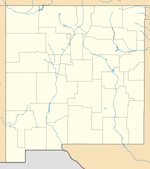
Fra Cristobal Range
| Fra Cristobal Range | |
|---|---|
 Fra Cristobal Range | |
| Highest point | |
| Peak | Fra Cristobal Mountain (Fra Cristobal Mountains) |
| Elevation | 6,003 ft (1,830 m) |
| Coordinates | 33°28′12″N 107°05′55″W / 33.47007°N 107.098641°W |
| Dimensions | |
| Length | 17 mi (27 km) N-S |
| Width | 6 mi (9.7 km) |
| Geography | |
| Country | United States |
| State | New Mexico |
| Regions | Jornada del Muerto and Rio Grande Valley |
| District | Sierra County NM |
| Settlement | Crocker, New Mexico |
| Range coordinates | 33°22′N 107°08′W / 33.36°N 107.13°WCoordinates: 33°22′N 107°08′W / 33.36°N 107.13°W |
| Borders on |
Elephant Butte Reservoir–Rio Grande-W Jornada del Muerto-E, NE & SE Elephant Butte, NM, Elephant Butte Dam-S (Truth or Consequences, NM–Eagle, NM-S) |
| Topo map | Black Bluffs, USGS quad |
The Fra Cristobal Range, (Fra Cristóbal Range) is a 17 mi (27 km) long, mountain range in central-north Sierra County, New Mexico. The range borders the eastern shore of Elephant Butte Reservoir on the Rio Grande, and the range lies towards the southwest of the Jornada del Muerto, the desert region east of the river.
Description
The Fra Cristobal Range is an arid, moderate elevation, north-south trending mountain range, about 17 mi long and narrow, only about 7 mi at its widest. Crater Hill, 5,087 feet (1,551 m) lies west of the central ridgeline, and north of Black Bluffs, Red Cliff at the Reservoir.
The highest peak in the range, Fra Cristobal Mountain, 6,003 feet (1,830 m),[1] is at the north perimeter of the range. It is located at 33°28′12″N 107°05′55″W / 33.47007°N 107.098641°W[2]
References
- ↑ New Mexico, DeLorme Atlas & Gazetteer, p. 38-39.
- ↑ Fra Cristobal Mountain Summit, mountainzone
External links
Range Highpoint
Fra Cristobal Range
- Crater Hill, (approximate range center (at west)), mountainzone, coordinates
- Fra Cristobal Range, mountainzone