Fanambana River
| Fanambana River | |
| River | |
 Fanambana river | |
| Country | |
|---|---|
| Region | Sava |
| City | Fanambana |
| Source | |
| - location | Marojejy Massif, Sava |
| - elevation | 1,815 m (5,955 ft) |
| Mouth | Indian Ocean |
| - location | Diana |
| - elevation | 0 m (0 ft) |
| - coordinates | MG 13°30′S 50°01′E / 13.500°S 50.017°ECoordinates: MG 13°30′S 50°01′E / 13.500°S 50.017°E |
| Length | 215 km (134 mi) |
| Basin | 1,827 km2 (705 sq mi) |
| Discharge | for at bridge RN 5a |
| - average | 4.5 m3/s (159 cu ft/s) |
| - max | 70.5 m3/s (2,490 cu ft/s) |
| - min | 3.4 m3/s (120 cu ft/s) |
| *Bauduin & Servat, Etude d'Hydrologie à usage Agricole - ORSTOM pp.1-829 - page 16 | |

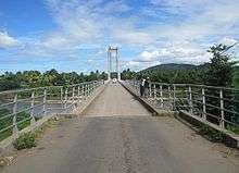
Fanambana river bridge
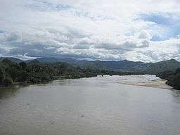
The Fanambana River is located in northern Madagascar and crosses the Route Nationale 5a near Morafeno. Its sources are situated in the Marojejy Massif and flows into the Indian Ocean south of Vohemar.
References
This article is issued from Wikipedia - version of the 3/21/2016. The text is available under the Creative Commons Attribution/Share Alike but additional terms may apply for the media files.