Escaut (department)

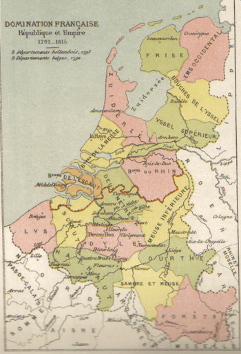
Escaut was a department of the First French Empire in present-day Belgium and Netherlands. It was named after the river Scheldt, which is called the Escaut in French. It was formed in 1795, when the Southern Netherlands were annexed by France. Before the occupation, the territory was part of the county of Flanders and the United Provinces (Staats-Vlaanderen).
The capital of the department was Ghent. The department was subdivided into the following arrondissements and cantons (situation in 1812):[1]
- Ghent, cantons: Deinze, Evergem, Ghent (4 cantons), Kruishoutem, Lochristi, Nazareth, Nevele, Oosterzele, Waarschoot and Zomergem.
- Dendermonde, cantons: Aalst (2 cantons), Beveren, Hamme, Lokeren, Sint-Gillis-Waas, Sint-Niklaas, Temse, Dendermonde, Wetteren and Zele.
- Eeklo, cantons: Assenede, Axel, Kaprijke, Eeklo, Sluis, Hulst, Oostburg and IJzendijke.
- Oudenaarde, cantons: Oudenaarde (2 cantons), Geraardsbergen, Herzele, Sint-Maria-Horebeke, Nederbrakel, Ninove, Ronse and Zottegem.
Its population in 1812 was 636,438, and its area was 357,000 hectares.[1]
After Napoleon was defeated in 1814, the department became part of the United Kingdom of the Netherlands. Its territory corresponded with the present Belgian province of East Flanders and the Dutch region of Zeeuws-Vlaanderen.
References
- 1 2 Almanach Impérial an bissextil MDCCCXII, p. 400-401, accessed in Gallica 24 July 2013 (French)
Coordinates: 51°3′N 3°44′E / 51.050°N 3.733°E