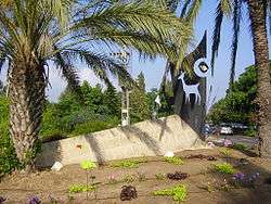
Ein Ayala
| Ein Ayala | |
|---|---|
 | |
 Ein Ayala | |
| Coordinates: 32°37′44.76″N 34°56′43.8″E / 32.6291000°N 34.945500°ECoordinates: 32°37′44.76″N 34°56′43.8″E / 32.6291000°N 34.945500°E | |
| District | Haifa |
| Council | Hof HaCarmel |
| Affiliation | Moshavim Movement |
| Founded | 1949 |
| Founded by | Czechoslovakian immigrants |
| Population (2015) | 1,127[1] |
| Website | www.einayala.co.il |
Ein Ayala (Hebrew: עֵין אַיָּלָה, lit. Doe Spring) is a semi-cooperative moshav in northern Israel. Located at the foot of Mount Carmel around 20 km south of Haifa, it falls under the jurisdiction of the Hof HaCarmel Regional Council. In 2015 it had a population of 1,127.
History
The moshav was founded in 1949 by immigrants from Czechoslovakia. According to Benny Morris, it is situated close to the depopulated Arab village of Ayn Ghazal,[2] but Walid Khalidi writes that it is not on Ayn Ghazal land,[3] but that Ein Ayala was founded on land belonging to Kafr Lam,[4] and cultivated land adjacent to Khirbat al-Sawamir.[5]
Today the moshav's main source of income is farming, mainly vegetables and fruit, although many residents work in nearby Haifa.
Ein Ayala Junction
Tzomet Ein Ayala (Hebrew: צומת עין איילה), between the Nahsholim and Ofer junctions, provides access to and from Highway 4 for cars traveling north or south along Israel's coastal plain.
References
- ↑ "List of localities, in Alphabetical order" (PDF). Israel Central Bureau of Statistics. Retrieved 16 October 2016.
- ↑ Morris, Benny (2004). The Birth of the Palestinian Refugee Problem Revisited. Cambridge University Press. p. xxii. ISBN 978-0-521-00967-6.
- ↑ Khalidi, Walid (1992). All That Remains: The Palestinian Villages Occupied and Depopulated by Israel in 1948. Washington D.C.: Institute for Palestine Studies. p. 148. ISBN 0-88728-224-5.
- ↑ Khalidi p170
- ↑ Khalidi, p191
External links
| Wikimedia Commons has media related to Ein Ayala. |
- Official website (Hebrew)