East Main Street Historic District (Brevard, North Carolina)
|
East Main Street Historic District | |
  | |
| Location | 249-683 and 768 East Main St.; 6-7 Rice St.; St. Phillip's Ln.; 1-60 Woodside Dr.; and 33 Deacon Ln., Brevard, North Carolina |
|---|---|
| Coordinates | 35°14′5″N 82°44′13″W / 35.23472°N 82.73694°WCoordinates: 35°14′5″N 82°44′13″W / 35.23472°N 82.73694°W |
| Area | 47 acres (19 ha) |
| Architect | Gaines, Henry I.; et al. |
| Architectural style | Bungalow/craftsman, Colonial Revival |
| MPS | Transylvania County MPS |
| NRHP Reference # | 09000638[1] |
| Added to NRHP | August 20, 2009 |
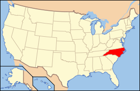
East Main Street Historic District is a national historic district located at Brevard, Transylvania County, North Carolina. It encompasses 14 contributing buildings, 1 contributing structure, and 1 contributing site in a predominantly residential section of Brevard. The district developed between about 1900 and 1959 and includes notable examples of Colonial Revival and Bungalow / American Craftsman style architecture. Located in the district are the separately listed St. Philip's Episcopal Church, Silvermont, William Breese, Jr., House, Charles E. Orr House, Royal and Louise Morrow House, and Max and Claire Brombacher House. Other notable buildings include the Lankford-Cleveland House (c. 1858, 1900), Brevard-Davidson River Presbyterian Church (1956, 1965, 1996), White House (c. 1900), Wyke-Barclay House (1905), and Carrier-Plummer House (1914).[2]
It was listed on the National Register of Historic Places in 2009.[1]
References
- 1 2 National Park Service (2010-07-09). "National Register Information System". National Register of Historic Places. National Park Service.
- ↑ Clay Griffith (April 2009). "East Main Street Historic District" (pdf). National Register of Historic Places - Nomination and Inventory. North Carolina State Historic Preservation Office. Retrieved 2014-08-01.

