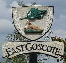
East Goscote

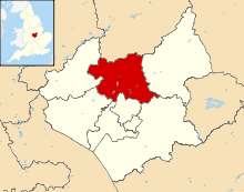
East Goscote is a village and civil parish in the Charnwood district of Leicestershire, England, just north of Syston. It is a medium-sized village with a population of approximately 3,000, measured at 2,866 in the 2011 census.[1] The village is twinned with Fleury-sur-Andelle, France.
The name is taken from East Goscote, one of the old hundreds (an area of land purported to be able to support 100 families) of Leicester. The Goscote Hundred (or Wapentake) is mentioned in the Domesday Book, this was later split into the West and East Goscote Hundreds.
It was the first new village to be created in Leicestershire since Domesday and is unique in the County.
The village is built on the site of a former army supply depot. According to Ministry of Defence files, the site was originally constructed in 1940 (finished September 1942) by Holloway Brothers, and was an Agency factory run by Lever Brothers/Unilever (No 10 ROF, Royal Ordnance Factory). At that time it was known as the Queniborough depot, since that was the closest village to it. It began production in March/April 1942. The aerial photograph reveals the road layout. According to English Heritage's reference work "Dangerous Energy" it was operating Groups 8-10 of ROF filling types (High Explosives received, mixed, and put into bombs and warheads). By 1944 it was temporarily occupied by the War Office. A report of 1951 has it designated as 78 COSD (Command Ordnance Sub Depot). It was decommissioned in 1959 and subsequently bought for housing development by Jelsons. This development began in 1962. There were two enormous shell storage bunkers that could not be demolished, and these were earthed over and landscaped. They are now part of the playing fields. These were opened to the public as part of the Queen's silver Jubilee celebrations in 1977, and there is a plaque near Long Furrow noting this fact.
Long Furrow serves as a perimeter road around the central part of the village, it also serves to mark the boundary of the former ordnance site. What is less well known is the huge network of large reinforced concrete tunnels that lay beneath the whole village where the munitions were fitted with their warheads, and new top secret weapons prototypes were put together. There are several entrances to these workshops and tunnels located throughout the village but each have been carefully landscaped to conceal their identity. Council representatives did enter these chambers and found that the tunnels were in excellent condition and the electricity still worked. Until the mid-1970s during which the village was still under construction both entrances to the 'Mound' were open and often visited by local children.
Today very little original information remains and those that know give little away. A map of the actual tunnel layout did exist in the Library of Wreake Valley College, Syston, but was misplaced to keep the tunnels hidden. The whole structure and stories that lay beneath its present inhabitants is worthy of a serious study, survey and television documentary. It is without doubt an excellent piece of environmental architecture and resource that could in the right hands be brought back to life. A whole world and unique 1940s time capsule could lay beneath our feet.
The first family to move in did so in 1965, even though the village lacked many amenities at the time, including street lighting.
The village is served by Broomfield County Primary School, which was opened in 1968. The school was expanded in 1977 to cope with the number of children on the village.
The original design made no mention of the village hall, and this was built by Jelsons free of charge. It was the home of religious services until the completion of St Hilda's church in 1976. The first village vicar was the Reverend Dudley Gummer who took services at his house in Coopers Nook until the village hall was built.
The village had its own magazine East Goscote Community News which was first published in 1969. It ceased publication in the mid-1980s after many issues. Now they have a magazine called Long Furrow.
Adjacent to the village is Beedles Lake Golf Club.
East Goscote is represented on Charnwood Borough Council by Councillor Cathy Duffy, the only elected representative in the locality from the far-right British National Party.[2]
Charnwood borough council has stated that there will be a new railway station to open at East Goscote, on the railway line towards Melton Mowbray.[3]
References
- ↑ "Civil Parish population". Neighbourhood Statistics. Office for National Statistics. Retrieved 11 June 2016.
- ↑ Booth, Robert (2009-10-20). "Analysis of a party – what the BNP list says about its members". London: The Guardian. Retrieved 2009-10-20.
- ↑ https://www.charnwood.gov.uk/static/local_plan/written/cpt7a.htm
External links
- grid reference SK640134
- Beedles Lake Golf Club
- Transmogrification of the Ordnance depot into the housing estate
- Broomfield County Primary School
Coordinates: 52°42′52″N 1°03′15″W / 52.71448°N 1.05404°W
External links
![]() Media related to East Goscote at Wikimedia Commons
Media related to East Goscote at Wikimedia Commons
