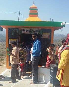
Devagiri hill
| Devagiri hill | |
|---|---|
 Sidhhi Vinayak Temple on the Devagiri hill | |
| Highest point | |
| Elevation | 394 ft (120 m) |
| Coordinates | 18°53′46″N 84°07′15″E / 18.89611°N 84.12083°ECoordinates: 18°53′46″N 84°07′15″E / 18.89611°N 84.12083°E |
| Geography | |
 Devagiri hill Devagiri hill | |
| Location | Rayagada district, Odisha, India |
| Parent range | Devagiri hills |
| Climbing | |
| Easiest route | Drive |
Devagiri hill rises to a height of 120.2 meters and is located at a distance of 50 km from Rayagada, Odisha, India. Unlike other hills, the top of the hill is a rectangular platform. The 476 steps with which one can reach the top is another unique feature of the hill. At the top of the hill, there are perenial poles of water called Ganga, Yamuna, Saraswati, Bhargavi and Indradyumna.
Tourist attractions near Devagiri hill
The hill is considered sacred due to presence of Panchamukhi(Five faced) Shiva Linga and Asta Linga(Eight Lingas) on the top of the hill.[1][2][3][4][5][6][7][8][9][10] There is a cave in the hill looking like two jaws.[11] There is one still undeciphered inscription which speaks of the antiquity of the place.[12] A Shiva Lingam is enshrined at the meeting of the two jaws.Regular bus services are available from Rayagada to K. Singpur and the sacred hill is close to K.Singpur.
References
- ↑ "Rayagada District: Introduction". 123orissa.com. Retrieved 25 June 2015.
- ↑ "Devagiri, a Religious Center in Rayagada, Odisha"
- ↑ "DEVAGIRI" rayagada.nic.in
- ↑ "Places of Interest in Rayagada" oriyaonline.com
- ↑ "Rayagada" indiatourismecatalog
- ↑ "Encyclopaedia of Tourism Resources in India, Volume 2" Google books
- ↑ "Cutural heritage of undivided Koraput District" Orissareview/2014/April–May
- ↑ "Rayagada- The Land Of Natural Beauty- By Manoj Senapati" nuaodisha.com
- ↑ "Interim Report"Odisha" tourism.gov.in
- ↑ "Rayagada district General information". indiaonapage.com. Retrieved 25 June 2015.
- ↑ "Devagiri" odisha360.com
- ↑ "Devgiri Hills" orissagateway.com