Demänovská Dolina
| Demänovská Dolina | |
| Village | |
 The forested Demänovská valley gives its name to the whole municipality | |
| Country | Slovakia |
|---|---|
| Region | Žilina |
| District | Liptovský Mikuláš |
| Elevation | 820 m (2,690 ft) |
| Coordinates | SK 48°58′13″N 19°34′55″E / 48.97028°N 19.58194°ECoordinates: SK 48°58′13″N 19°34′55″E / 48.97028°N 19.58194°E |
| Area | 47.878 km2 (18.49 sq mi) |
| Population | 203 (2004-12-31) |
| Density | 4/km2 (10/sq mi) |
| Founded | 1964 |
| Postal code | 032 51 |
| Car plate | LM |
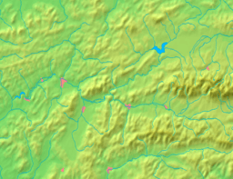
  Location of Demänovská Dolina in Slovakia
| |
  Location of Demänovská Dolina in the Žilina Region
| |
| Statistics: MOŠ/MIS | |
| Website: www.demanovskadolina.info | |
Demänovská Dolina is a village and municipality in Liptovský Mikuláš District in the Žilina Region of northern Slovakia. More precisely, it is situated in Demänovská valley, where Demänovská Cave of Liberty and Demänovská Ice Cave can be found.
History
The municipality was founded in 1964.
Geography
The municipality lies at an altitude of 690 metres and covers an area of 47.878 km². It has a population of about 340 people.
External links
![]() Media related to Demänovská dolina at Wikimedia Commons
Media related to Demänovská dolina at Wikimedia Commons
This article is issued from Wikipedia - version of the 2/12/2014. The text is available under the Creative Commons Attribution/Share Alike but additional terms may apply for the media files.