Cyclone Kate (2006)
| Category 2 tropical cyclone (Aus scale) | |
|---|---|
| Tropical storm (Saffir–Simpson scale) | |
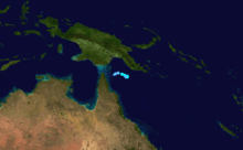
.jpg) Satellite image of Cyclone Kate near peak intensity | |
| Formed | 22 February 2006 |
| Dissipated | 24 February 2006 |
| Highest winds |
10-minute sustained: 95 km/h (60 mph) 1-minute sustained: 85 km/h (50 mph) Gusts: 120 km/h (75 mph) |
| Lowest pressure | 985 hPa (mbar); 29.09 inHg |
| Fatalities | None reported |
| Areas affected | Papua New Guinea and Queensland, Australia |
| Part of the 2005–06 Australian region cyclone season | |
Tropical Cyclone Kate was a short-lived Category 2 cyclone that remained nearly stationary for its entire existence in the northwestern Coral Sea in February 2006. Forming out of a monsoonal trough on 22 February, Kate rapidly intensified throughout the day. By 23 February, the system attained its peak intensity with winds of 95 km/h (60 mph 10-minute sustained) and a barometric pressure of 985 hPa (mbar). Shortly thereafter, increasing wind shear caused the storm to quickly weaken. By 24 February, the system dissipated over open waters near Queensland, Australia. Although Kate did not directly affect land, large swells produced by the storm impaced beaches in Papua New Guinea and Queensland. The waves injured six people in Australia, although no property damage was reported.
Meteorological history

Cyclone Kate originated from an area of low pressure that was first identified on 22 February 2006, within a monsoonal trough.[1] The system rapidly intensified throughout the day, with the Australian Bureau of Meteorology issuing their first advisory on the system that evening. Upon being classified, the system was immediately declared Tropical Cyclone Kate, skipping tropical low status.[2] At the same time, the Joint Typhoon Warning Center (JTWC) also began issuing advisories on the system, designating it as Tropical Cyclone 13P.[3] The storm had developed well-defined, upper-level outflow enhanced by diffluence over the system.[4]
The system remained nearly stationary over the northwestern Coral Sea.[1] Early on 23 February, the storm attained its peak intensity with winds of 95 km/h (60 mph 10-minute sustained) and a barometric pressure of 985 hPa (mbar).[2] However, the JTWC assessed the system to have been slightly weaker, attaining peak winds of 85 km/h (50 mph 1-minute sustained).[3] Further intensification was anticipated as Kate slowly tracked towards Queensland, Australia.[5] However, Kate stalled shortly thereafter and began to weaken due to increasing wind shear.[1] Rapid weakening took place throughout the day, and JTWC declared the system dissipated early on 24 February.[3] The Bureau of Meteorology downgraded Kate to a tropical low around the same time, although they continued to monitor the storm for several more hours before reporting that it had dissipated over open waters.[2]
Preparations and impact
Upon the cyclone's formation, the Bureau of Meteorology warned vessels to avoid the storm in anticipation of rough seas and winds gusting to 125 km/h (78 mph).[6] Although the storm did not pose much of a threat to Queensland, officials urged residents to ensure their disaster kits were ready and that preparations for a moderate storm, such as storing lose outdoor objects and clearing gutters, had been completed.[7]
While the storm had no direct impact on land, large swells affected most of the Queensland coastline. In the Shire of Noosa, six surfers sustained serious injuries after wading into turbulent waters. Waves up to 1.8 m (5.9 ft) tossed the six surfers, leaving them with injuries ranging from broken noses and fractured ankles to head wounds from surfboards.[8] The waves also caused additional beach erosion to parts of Papua New Guinea previously impacted by Cyclone Ingrid in March 2005.[1]
See also
References
- 1 2 3 4 Gary Padgett (2 May 2006). "Monthly Tropical Weather Summary for February 2006". Typhoon 2000. Retrieved 12 January 2010.
- 1 2 3 "Australian Region Tropical Cyclone Best Tracks". Australian Bureau of Meteorology. 2009. Retrieved 23 December 2009.
- 1 2 3 Joint Typhoon Warning Center (2007). "Tropical Cyclone 15S Best Track". United States Navy. Retrieved 12 January 2009.
- ↑ Joint Typhoon Warning Center (22 February 2006). "Tropical Cyclone 13P Advisory NR 001". Unisys Weather. Retrieved 12 January 2010.
- ↑ Joint Typhoon Warning Center (23 February 2006). "Tropical Cyclone 13P Advisory NR 002". Retrieved 12 January 2010.
- ↑ Staff Writer (23 February 2006). "Cyclone Kate south of Papua New Guinea capital". Radio New Zealand. Retrieved 27 December 2009.
- ↑ Staff Writer (24 February 2006). "Cyclone Kate intensifies off far-north Qld". ABC Australia. Retrieved 27 December 2009.
- ↑ Staff Writer (25 February 2006). "Surfers hurt by wild waves". Sunshine Coast Daily. Retrieved 27 December 2009.
External links
- Australian Bureau of Meteorology (TCWC's Perth, Darwin & Brisbane)
- Joint Typhoon Warning Center (JTWC)