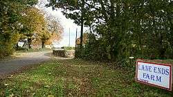
Common End, Derbyshire
| Common End | |
 Out Lane |
|
 Common End |
|
| OS grid reference | SK440640 |
|---|---|
| Civil parish | Ault Hucknall |
| District | Bolsover |
| Shire county | Derbyshire |
| Region | East Midlands |
| Country | England |
| Sovereign state | United Kingdom |
| Post town | CHESTERFIELD |
| Postcode district | S44 |
| Police | Derbyshire |
| Fire | Derbyshire |
| Ambulance | East Midlands |
| EU Parliament | East Midlands |
|
|
Coordinates: 53°10′50″N 1°20′45″W / 53.18051°N 1.34578°W
Common End is a place noted on a map of Derbyshire, England. It is located eight miles south-east of Chesterfield.[1]
References
- ↑ Common End, Ordnance survey
- The geographic coordinates are from the Ordnance Survey.
This article is issued from Wikipedia - version of the 1/23/2016. The text is available under the Creative Commons Attribution/Share Alike but additional terms may apply for the media files.