Clover Bar Road

Clover Bar Road
Range Road 231
Maintained by Strathcona County
Length 10.4 km (6.5 mi)
Location Sherwood Park
South end Alberta Highway 628 (Township Road 522)
Major
junctions
Alberta Highway 628, Wye Road, Baseline Road, Alberta Highway 16
North end Alberta Highway 16 (Yellowhead Highway)
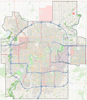
Start/End points of Clover Bar Road

Clover Bar Road is a major arterial road in Sherwood Park, Alberta, Canada. Like all arteries of Sherwood Park, it does not run straight, has no street number, and mostly runs through residential.

Neighbourhoods

List of neighbourhoods Clover Bar Road runs through, in order from south to north.

Interchanges and intersections

This is a list of major intersections, starting at the south end of Clover Bar Road.

Direction Intersecting road Current intersection type Coordinates
South-North Alberta Highway 628 (Township Road 522, Whitemud Drive) At-grade 53°28′59″N 113°16′16″W / 53.48306°N 113.27111°W / 53.48306; -113.27111 (Clover x 628)
Deer Mountain Trail At-grade 53°29′14″N 113°16′16″W / 53.48722°N 113.27111°W / 53.48722; -113.27111 (Clover x Mountain)
Windsor Drive / Sconadale Road At-grade 53°29′35″N 113°16′17″W / 53.49306°N 113.27139°W / 53.49306; -113.27139 (Clover x Windsor)
Thomson Road At-grade 53°30′20″N 113°16′16″W / 53.50556°N 113.27111°W / 53.50556; -113.27111 (Clover x Thomson)
Wye Road At-grade (traffic lights) 53°30′44″N 113°16′14″W / 53.51222°N 113.27056°W / 53.51222; -113.27056 (Clover x Wye)
Nottingham Boulevard / Raymond Way At-grade (traffic lights) 53°30′58″N 113°16′14″W / 53.51611°N 113.27056°W / 53.51611; -113.27056 (Clover x Nottingham)
Southwest-Northeast Granada Boulevard / Regency Drive At-grade (traffic lights) 53°31′13″N 113°15′57″W / 53.52028°N 113.26583°W / 53.52028; -113.26583 (Clover x Granada)
South-North Colwill Boulevard At-grade (traffic lights) 53°31′45″N 113°15′48″W / 53.52917°N 113.26333°W / 53.52917; -113.26333 (Clover x Colwill)
Craigavon Drive / Highland Drive At-grade (traffic lights) 53°32′2″N 113°15′48″W / 53.53389°N 113.26333°W / 53.53389; -113.26333 (Clover x Craigavon)
Baseline Road At-grade (traffic lights) 53°32′28″N 113°15′48″W / 53.54111°N 113.26333°W / 53.54111; -113.26333 (Clover x Baseline)
Carson Drive / Primrose Boulevard At-grade (traffic lights) 53°32′46″N 113°15′48″W / 53.54611°N 113.26333°W / 53.54611; -113.26333 (Clover x Carson)
Southeast-Northwest Cranberry Drive / Davidson Drive At-grade (traffic lights) 53°33′4″N 113°16′9″W / 53.55111°N 113.26917°W / 53.55111; -113.26917 (Clover x Cranberry)
South-North Lakeland Drive At-grade (traffic lights) 53°33′24″N 113°16′35″W / 53.55667°N 113.27639°W / 53.55667; -113.27639 (Clover x Lakeland)
Alberta Highway 16 (Yellowhead Highway) Partial cloverleaf interchange 53°34′13″N 113°16′15″W / 53.57028°N 113.27083°W / 53.57028; -113.27083 (Clover x 16)

References


    This article is issued from Wikipedia - version of the 1/31/2015. The text is available under the Creative Commons Attribution/Share Alike but additional terms may apply for the media files.