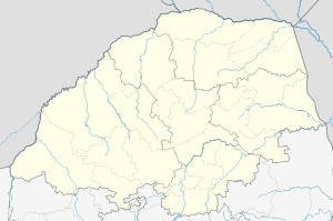
Chuniespoort
| Chuniespoort | |
|---|---|
 Chuniespoort  Chuniespoort  Chuniespoort
| |
| Coordinates: 24°13′45″S 29°29′48″E / 24.22917°S 29.49667°ECoordinates: 24°13′45″S 29°29′48″E / 24.22917°S 29.49667°E | |
| Country | South Africa |
| Province | Limpopo |
| District | Capricorn |
| Municipality | Polokwane |
| Area[1] | |
| • Total | 1.91 km2 (0.74 sq mi) |
| Population (2011)[1] | |
| • Total | 1,271 |
| • Density | 670/km2 (1,700/sq mi) |
| Racial makeup (2011)[1] | |
| • Black African | 100.0% |
| First languages (2011)[1] | |
| • Northern Sotho | 92.5% |
| • Tsonga | 4.6% |
| • Zulu | 1.0% |
| • Other | 1.8% |
| Postal code (street) | 0745 |
| PO box | 0745 |
| Area code | 015 |
Chuniespoort (recently Chuenespoort[2]) is a mountain pass situated in the Limpopo Province, on the R37, the road between Polokwane and Lebowakgomo, South Africa. The river flowing through this gorge of the Strydpoort Mountains is known as the Chunies River, one of the tributaries of the Olifants River.[3]
Etymology
The name commemorates the name of an African leader, whose name would be spelt Tshwene in modern Northern Sotho orthography.[2]
References
- 1 2 3 4 "Main Place Chuniespoort". Census 2011.
- 1 2 Jenkins, Elwyn (2007), Falling into place: the story of modern South African place names, David Philip Publishers, p. 75
- ↑ Environmental Management Framework for the Olifants and Letaba Rivers Catchment area
This article is issued from Wikipedia - version of the 3/8/2015. The text is available under the Creative Commons Attribution/Share Alike but additional terms may apply for the media files.
.svg.png)