Chelannur
| Chelannur | |
|---|---|
| Village | |
|
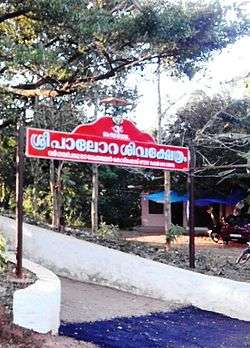
Purakkattiri Temple | |
 Chelannur Location in Kerala, India | |
| Coordinates: 11°20′30″N 75°48′30″E / 11.34167°N 75.80833°ECoordinates: 11°20′30″N 75°48′30″E / 11.34167°N 75.80833°E | |
| Country |
|
| State | Kerala |
| District | Kozhikode |
| Government | |
| • Type | Democratic |
| Population (2011) | |
| • Total | 40,697 |
| Languages | |
| • Official | Malayalam, English |
| Time zone | IST (UTC+5:30) |
| PIN | 673616 |
| Vehicle registration | KL-11,KL-57 |
| Website | www.chelannur.in |
Chelannur is a village in Kozhikode district in the state of Kerala, India.The village is currently ruled by the Left Democratic Front (LDF).[1]
Demographics
As of 2011 India census, Chelannur has a population of 40,697 with 19,574 males and 21,123 females.
Important Landmarks
- Ette Randu: 8/2 also known as the 8.2 mile road is the hub of Chelannur.
- Ollopara,a scebuc place in Chelannur were a lot of movies have been shot.
- Shri Krishna Temple, Ambalappad
- Parappurath Shri Nagakali Temple, Chelannur
- Maruthad Rahma Juma Masjidh, Chelannur
- Sree Kizhakkayil Baghavathy Temple Pulibazar
- Panama Soaps, Kakkodi
- Subramanya Swamy Temple, Vengeri
- Homeo College, Karikkamkulam Junction
Education
Chelannur has lot of educational institutions.According to census 2011 more than 98% of students below 16 years are going to school There are currently two higher secondary schools in Chelannur namely AKKR Girls higher secondary school and Sree Narayana Guru college.
Suburbs and Villages
- Kakkoor, Ambalathukulangara and Kumaraswamy Junction
- Kakkodimukkum Kakkodi, Muttoli and Thanneer Panthal
- Vengeri and Thadambattu Thazham.
References
http://www.keralabanking.com/html/Chelannur.htm
This article is issued from Wikipedia - version of the 7/7/2016. The text is available under the Creative Commons Attribution/Share Alike but additional terms may apply for the media files.
