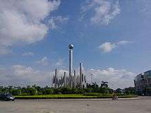
Chaolian Subdistrict
Chaolian Subdistrict is a subdistrict of Pengjiang District, Jiangmen, Guangdong, China. It covers an area of 12 square kilometers, with a population of 12,000.[1]

Geography
Chaolian Subdistrict is an island lying on Xijiang River. In the east of Pengjiang District, Chaolian, as an island, is near to many other places, with Hetang to its north, Huanshi and Beijie to its west, Waihai to its south, and Guzhen, Zhongshan to its east.[2]
History
Chaolian was a subdistrict called Hua'e Du of Xinhui District in Qing Dynasty; in the Republic of China period, it was under the 4th section of Xinhui District; in 1955, under Waihai District; in October, 1958, under Waihai community commune; in 1961, under Hetang community commune; in September 24, 1977, Chaolian became a part of Jiangmen, and Chaolian community commune was found; in 1983, Chaolian District was found, but in 1987, it became a Town(subdistrict), and in 2000, Chaolian Subdistrict was announced and continues to be it.
Administrative Divisions
In Chaolian Subdistrict, there are six communities: Tangbian, Zhishan, Fugang, Lubian, Tanbian, and Zhaigang.
Climate
With mild weather and plenty of rainfall, it produces abundant crops. Chaolian has a subtropical monsoon climate.[1]
Economy
Since the Reform and Opening, Chaolian, as a famous hometown of overseas Chinese, has developed its economy with the help of foreign investment and local capital.
On the completion of Chaolian Bridge and Xijiang Bridge, Chaolian became an important transportation crossroad among Shunde, Foshan, and Panyu.
Chaolian is called "The Island of Diamond" after Henghe Diamond Co. Ltd.(Jiangmen) set its home there. With the construction of "The Island of Diamond", the Xijiang View Food Street, and Jiangmen Polytechnic, Chaolian will develop its economy base on travelling, entertainment, and shopping.[1]
Touring
- Hongsheng Park is in Fugang. In the north of Chaolian island, facing Xijiang, it is the expansion of Hongsheng Buddha Hall in 1984. It covers an area of more than 15,000 square meters, with beautifully designed structures. The artificial lake is quiet and beautiful with bridges and pavilions. The park is full of plants, from roses to peach flowers, mellows to bamboos.The main historical sites are Hongsheng Buddha Hall, the Loving Mother Pavilion, and the Four-Eyes-Well.
- Chaolian Beach Park is a place for barbecue, exercising, swimming, and relaxing.
- Lubian Ancestral Hall is in Lubian. It is famous for its ancient Chinese style architecture. Now it serves as a small museum for exhibition of paintings and photographs of local artists.
Education
- Chaolian Central Kindergarten is in Lubian, and it is the biggest kindergarten in Chaolian.
- Yongsi Primary School is in Zhishan. It serves local children mainly.
- Chaolian Central School has its primary school section and its junior high school section. It locates at Lubian.[3]
- Jiangmen Polytechnic is a higher education facility with a 30-year history, and it relocated in Chaolian in 2004.[4]
References
Coordinates: 22°37′31″N 113°07′03″E / 22.6252°N 113.1174°E