Bugyals

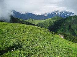
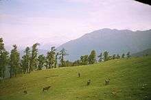
Bugyals are alpine pasture lands, or meadows, in higher elevation range between 3,300 metres (10,800 ft) and 4,000 metres (13,000 ft) of the Himalayas in the Indian state of Uttarakhand, where they are called "nature’s own gardens".[1] The topography of the terrain is either flat or sloped. The surface of these bugyals is covered with natural green grass and seasonal flowers. They are used by tribal herdsmen to graze their cattle. During the winter season the alpine meadows remain snow-covered. During summer months, the Bugyals present a riot of beautiful flowers and grass. As bugyals constitute very fragile ecosystems, particular attention needs to be given for their conservation.[1]
Some of the notable bugyals are: Auli near Joshimath, Garsi, Kwanri, Bedni, Panwali and Kush Kalyan, Dayara and Munsiyari.[2]
Auli Bugyal


Auli Bugyal in Chamoli district,[3] a highland pasture in the Garhwal Himalaya[4] is known as the "Heaven Terrace".[5] It lies in an elevation range of 2,500–3,050 metres (8,200–10,010 ft) with ski slopes located at an elevation of 3,048 metres (10,000 ft). On either side of the bugyal there are coniferous, oak and deodhar forests which limits the wind velocity to acceptable 16 kilometres (9.9 mi) for skiing.[6] It is in the backdrop of Nanda Devi (7,817 metres (25,646 ft)), Kamet (7,756 metres (25,446 ft)), Mana Parvat (7,273 metres (23,862 ft)), Dunagiri mountain (7,066 metres (23,182 ft)), Hati Parvat (6,727 metres (22,070 ft)), Bethantoli (6,353 metres (20,843 ft)) and Ghora Parvat peaks of the Himalayas. The trek to Auli passes through lush vegetation of apple orchards and oak forest.[7][8] The ski slopes are said to better than those at Gulmarg. During the winter months (January to March) the slopes are covered with a mantle of snow which is spread over a width of 3 kilometres (1.9 mi),[9] and has a thickness 8–10 feet (2.4–3.0 m).[10] It is a skiing resort with modern skiing equipment.[11] It is the venue of skiing festivities and the annual national championship of skiing held during February and March. It is 13 kilometres (8.1 mi) away from Joshimath. A 500 metres (1,600 ft) ski-lift system exists here which is believed to be the longest cable car (3.9 kilometres (2.4 mi)) from Joshimath to the top most station at Gorson. It is the only location where artificial snow making system is provided to ensure that snow is present on the slopes for skiing. There are also two snow beaters which are used to make the snow slopes fit for skiing.[6] As it is a winter sports centre and Vayudoot two airports have been planned in the region.[4] R. V. Vernede, the British Deputy High Commissioner of the district during the British Raj had built a hut known as “Vernede” here at an elevation of 11,000 feet (3,400 m).[3] It is under the control of the Garhwal Vikas Manadl, which also provides for all skiing gear at site.[9]
Auli Bugyal is a very large alpine meadow which has expanse of grass land that covers several hundred acres of land, towards the sides of a wide ridge; Bedni Bugyal lies beyond this ridge. The meadows have vegetation of anemones, Potentilla, lousewort, wild Salvia and thistles. Grazing by cattle and sheep is extensive. There are many trails that pass through the meadows.[12]
Bedni Bugyal

Meadows of the Bedni Bugyal in Chamoil district,[13] are at an elevation of 3,350 metres (10,990 ft).[14] Alpine camps are established here for the pilgrims to visit the Rup Kund ('Kund' meaning "lake"), which is covered with snow for 10 months in a year.[15] From this camp to its west, views of the Himalayan peaks of the Gangotri, the Trishul and the Nanda Ghunti provide a scenic backdrop. This budyal also has a small lake called Bedini Kund.[15][16] It is an artificial lake built with a concrete dyke by reclaiming a marshy wetland. There are two shrines here, one a small temple of Nanda Devi and the other a shrine for Latu. The temple is built with stones without using any mortar but moss growth is seen in the crevices. The Nanda Devi temple has two small carved stone images of the goddess and a pure white conch shell.[17] Bedni and Rup Kund are approached from Karnaprayag.[13] Medicinal herbs are found here.[18]
Tungnath Bugyal

Tunganath Bugyal is at an elevation of 3,400 metres (11,200 ft) and consists of moss cover over soil mantle on rock surface.[19]
Dayara Bugyal
Dayara Bugyal, in Uttarkashi district, meaning "high altitude meadow" is at an elevation of 3,408 metres (11,181 ft). The beautiful meadows are developed into ski slopes covering an area of 28 square kilometres (11 sq mi).[20] It has also been planned as a skiing resort.[11] It is approached from Uttarkashi, up to village Barsu by road and further 6 kilometres (3.7 mi) by trekking.[20]
Other Bugyals
On the Gangorti-Kedarnath trekking route the notable bugyals are Panwali (3,963 metres (13,002 ft)) and Kush-Kalyani.[21] Gorson Bugyal (11,500 feet (3,500 m)) is near Joshimath.[22] In the alpine meadows of Uttaranchal other bugyals are Rajrambha, Marjhali, Rajthor, Darmithor, Bishanthor, Galpari, Sankalpa, Yangchari, and Shibu Gwar.[23]jerai bugyal in almora district.
Conservation issues
Bugyal is a fragile ecosystem and it is essential to maintain a balance between ecology and environment. In this context a court case was filed by the public objecting to erection of the prefab houses and by introducing non-biodegradable matter in the upper meadows of the bugyals by the tourism departments. It was averred that the peace and tranquility of the bugyals was getting affected. The court had ordered that the polluter must pay for the damage to environment based on absolute liability principle, which covered payment of damages to the affected people but also to compensate for all costs for restoration of the degraded environments.[24]
References
- 1 2 Tmh, p. 93.
- ↑ Tmh. General Knowledge Digest 2010. Tata McGraw-Hill Education. pp. 1–. ISBN 978-0-07-069939-7.
- 1 2 Prasad 2009, p. 62.
- 1 2 The India Magazine of Her People and Culture. A. H. Advani. 1987. p. 93.
- ↑ Bisht 2008, p. 61.
- 1 2 Goyal 2014, p. 151.
- ↑ Goyal & 2014 p-151.
- ↑ Sûrya India. A. Anand. 1992.
- 1 2 Pandey & Pandey 2003, p. 242.
- ↑ Thapliyal 2005, p. 215.
- 1 2 Nigam 2002, p. 139.
- ↑ Alter 2015, p. 110.
- 1 2 Goyal 2014, p. 111.
- ↑ Betts & McCulloch 2014, p. 120.
- 1 2 Weare 2009, p. 173.
- ↑ Singhal 2013, p. 173.
- ↑ Alter 2015, p. 111.
- ↑ Singh 2004, p. 196.
- ↑ Rai & Upreti 2013, p. 96.
- 1 2 Sharma 2008, p. 262.
- ↑ Kohli 1983, pp. 95–96.
- ↑ Yadav 1989, p. 177.
- ↑ Rawat 2005, p. 22.
- ↑ Bhatt 2004, p. 51.
Bibliography
- Alter, Stephen (10 March 2015). Becoming a Mountain: Himalayan Journeys in Search of the Sacred and the Sublime. Skyhorse Publishing Company, Incorporated. ISBN 978-1-62872-542-1.
- Bahuguna, Sunderlal (1997). Fire in the Heart, Firewood on the Back. Parvatiya Navjeevan Mandal.
- Bhatt, Saligram (2004). Environment Protection and Sustainable Development. APH Publishing. ISBN 978-81-7648-512-8.
- Bisht, P. S. (1 January 2008). Tourist Resources and Development in Himalayas. Anamika Publishers & Distributors. ISBN 978-81-7975-231-9.
- Goyal, Ashutosh (1 May 2014). RBS Visitors Guide INDIA – Uttarakhand: Uttarakhand Travel Guide. Data and Expo India Pvt. Ltd. ISBN 978-93-80844-79-4.
- Betts, Vanessa; McCulloch, Victoria (10 February 2014). Indian Himalaya Footprint Handbook: Includes Corbett National Park, Darjeeling, Leh, Sikkim. Footprint Travel Guides. ISBN 978-1-907263-88-0.
- Kohli, M.S. (1983). The Himalayas: Playground of the Gods – Trekking, Climbing and Adventures. Indus Publishing. ISBN 978-81-7387-107-8.
- Nigam, Devesh (2002). Tourism, Environment, and Development of Garhwal Himalaya. Mittal Publications. ISBN 978-81-7099-870-9.
- Pandey, Dinesh Chandra; Pandey, Puran C. (1 January 2003). Environmental Resources and Tourism Development in the Himalaya. Anamika Publishers & Distributors. ISBN 978-81-7975-054-4.
- Prasad, Mahesh (2009). No, Minister: Memoirs of a Civil Servant. Macmillan India. ISBN 978-0-230-63647-7.
- Rai, Himanshu; Upreti, Dalip K. (11 December 2013). Terricolous Lichens in India: Volume 2: Morphotaxonomic Studies. Springer Science & Business Media. ISBN 978-1-4939-0360-3.
- Rawat, G. S. (2005). Alpine Meadows of Uttaranchal: Ecology, Landuse, and Status of Medicinal & Aromatic Plants. Bishen Singh Mahendra Pal Singh. ISBN 978-81-211-0464-7.
- Singhal, Yogy (18 November 2013). The Human Trinity. Partridge Publishing. ISBN 978-1-4828-1387-6.
- Sharma, Dr. Shiv (2008). India – A Travel Guide. Diamond Pocket Books (P) Ltd. ISBN 978-81-284-0067-4.
- Singh, Tapeshwar (2004). Resource Conservation and Food Security: An Indian Experience. Concept Publishing Company. ISBN 978-81-8069-101-0.
- Thapliyal, Uma Prasad (2005). Uttaranchal: Historical and Cusltural Perspectives. B.R. Publishing Corporation. ISBN 978-81-7646-463-5.
- Tmh, Tmh. General Knowledge Digest 2010. Tata McGraw-Hill Education. ISBN 978-0-07-069939-7.
- Weare, Garry (2009). Trekking in the Indian Himalaya. Lonely Planet. ISBN 978-1-74059-768-5.
- Yadav, Hridai Ram (1 January 1989). Dimensions of Wastelands Development: Proceedings of the National Seminar on Wastelands Development, New Delhi, 1986. Concept Publishing Company. ISBN 978-81-7022-264-4.