Brunswick Town Historic District
|
Brunswick Town Historic District | |
|
| |
  | |
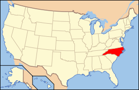
| Location | N of Southport off SR 133, near Southport, North Carolina |
|---|---|
| Coordinates | 34°02′27″N 77°56′41″W / 34.04083°N 77.94472°WCoordinates: 34°02′27″N 77°56′41″W / 34.04083°N 77.94472°W |
| Area | 225 acres (91 ha) |
| NRHP Reference # | 78001932[1] |
| Added to NRHP | September 6, 1978 |
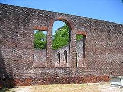
The Brunswick Town Historic District encompasses the ruins of colonial Brunswick Town, North Carolina, the Civil War-era Fort Anderson, St. Philip's Church Ruins, and the remains of Russellborough, the home of two colonial governors. The 2,250-acre (910 ha) district is located in the Smithville Township of Brunswick County, between Wilmington and Southport. In September 1978, the Brunswick Town Historic District was added to the National Register of Historic Places.[2]
See also
References
- ↑ National Park Service (2010-07-09). "National Register Information System". National Register of Historic Places. National Park Service.
- ↑ "North Carolina - Brunswick County - Historic Districts". nationalregisterofhistoricplaces.com. Retrieved 2008-05-09.
External links
- Historic American Engineering Record (HAER) No. NC-50, "Brunswick Town Colonial Wharf, 8884 Saint Philip's Road, Southeast, Winnabow, Brunswick County, NC", 13 photos, 2 photo caption pages
This article is issued from Wikipedia - version of the 11/26/2016. The text is available under the Creative Commons Attribution/Share Alike but additional terms may apply for the media files.


